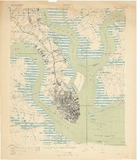
1919 Map of Charleston
USGS Topo · Published 1919About this map
Charleston and its surrounding tidal waterways are documented in high detail just after the First World War, showing the city's dense grid bounded by the Ashley River and Cooper River. To the north, the U.S. Naval Reservation and Navy Yard occupy significant riverfront territory, supported by Wireless Towers and a complex network of tracks including the Seaboard Air Line and the Southern Railway. The landscape transitioning into the countryside features distance-named settlements like Fivemile House and Sixmile House along the Dorchester Road. Maritime history is etched across the harbor, from the Quarantine Anchorage and Castle Pinckney to the outer defenses at Fort Sumter. Local genealogists will find value in the precise locations of the Magnolia Cem. and St Lawrence Cem., alongside smaller communities like Ashley Junction (Horse Pond P.O.) and Albemarle.
Find a feature on this map
84 named features on this map. Tap any name to fly to it.
Don’t see what you’re looking for? This feature index may not catch every label — zoom into the map to look around manually.
Map Details
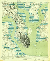
Editions of this 1919 Charleston Map
3 editions found
Other maps of this area

1919 · Ladson
USGS Topo · 1:21,120

1919 · Johns Island
USGS Topo · 1:21,120

1919 · The Jetties
USGS Topo · 1:21,120

1919 · Wadmelaw Island
USGS Topo · 1:62,500

1919 · Wando
USGS Topo · 1:21,120

1919 · Melgrove
USGS Topo · 1:21,120

1919 · Charleston
USGS Topo · 1:21,120

1919 · James Island
USGS Topo · 1:21,120

1919 · Fort Moultrie
USGS Topo · 1:21,120

1919 · Legareville
USGS Topo · 1:21,120