
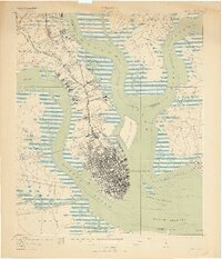
1919 Map of Charleston
USGS Topo · Published 1919About this map
The dense urban grid of Charleston occupies the peninsula between the Ashley River and Cooper River, shown here just after the First World War. This landscape is defined by its deep-water naval and military infrastructure, most notably the U S Naval Reservation and the Navy Yard further north. The coastal defenses at the harbor entrance include the legendary Fort Sumter, Fort Johnson, and the island battery at Castle Pinckney.
Find a feature on this map
76 named features on this map. Tap any name to fly to it.
Don’t see what you’re looking for? This feature index may not catch every label — zoom into the map to look around manually.
Map Details
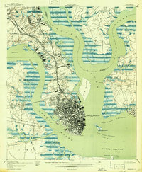
Editions of this 1919 Charleston Map
3 editions found
Other maps of this area

1919 · Ladson
USGS Topo · 1:21,120

1919 · Johns Island
USGS Topo · 1:21,120

1919 · The Jetties
USGS Topo · 1:21,120

1919 · Wadmelaw Island
USGS Topo · 1:62,500

1919 · Wando
USGS Topo · 1:21,120

1919 · Melgrove
USGS Topo · 1:21,120

1919 · James Island
USGS Topo · 1:21,120

1919 · Fort Moultrie
USGS Topo · 1:21,120

1919 · Legareville
USGS Topo · 1:21,120

1920 · Ravenels
USGS Topo · 1:62,500
Featured Places
- Charleston, SC
- North Charleston, SC
- Mount Pleasant, SC
- Ashley Junction, North Charleston
- Daniel Jenkins Homes, North Charleston