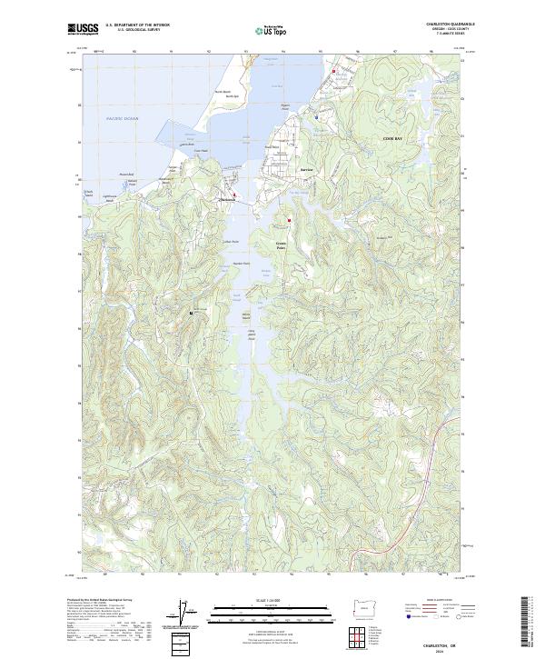
2024 Map of Charleston
USGS Topo · Published 2024About this map
The coastal village of Charleston serves as the focal point for this survey of the Coos Bay entrance and its complex network of sloughs. Just south of the spit, the shoreline is defined by notable landmarks such as Coos Head and the high vantage point of Yoakam Hill. The landscape transitions from the open waters of the Pacific Ocean to the sheltered waters of South Slough, where the South Slough Cem remains a quiet marker of the area's local genealogy.
Find a feature on this map
103 named features on this map. Tap any name to fly to it.
Don’t see what you’re looking for? This feature index may not catch every label — zoom into the map to look around manually.
Map Details
Editions of this 2024 Charleston Map
This is the sole edition of this map. No revisions or reprints were ever made.
Other maps of this area

1896 · Coos Bay
USGS Topo · 1:125,000

1898 · Coos Bay
USGS Topo · 1:125,000

1900 · Coos Bay
USGS Topo · 1:125,000

1942 · Empire
USGS Topo · 1:62,500

1942 · Coquille
USGS Topo · 1:62,500

1942 · Coos Bay
USGS Topo · 1:62,500

1943 · Bandon
USGS Topo · 1:62,500

1944 · Empire
USGS Topo · 1:62,500

1944 · Bandon
USGS Topo · 1:62,500

1945 · Coquille
USGS Topo · 1:62,500