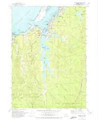
1970 Map of Charleston
USGS Topo · Published 1974About this map
Coos Bay and the coastal village of Charleston dominate this coastal survey, where the Pacific tide cycles through South Slough and Joe Ney Slough. The landscape reflects a specialized maritime and research economy, featuring the Oreg Inst of Marine Biology (Univ of Oreg) and a significant US Naval Facility at Coos Head. Along the rocky coastline, the Cape Arago Lighthouse stands watch near Gregory Point, while inland, the topography is carved by numerous drainages like Hayward Creek and Seven Devils Creek. The map documents a transition from industrial and military utility to conservation and agriculture, marked by the extensive Cranberry Bogs near Barview and protected acreage within Sunset Bay State Park and Shore Acres State Park. To the south, the deep woods of the Coos County Forest are accessed by a network of Jeep Trails and pack paths.
Find a feature on this map
72 named features on this map. Tap any name to fly to it.
Don’t see what you’re looking for? This feature index may not catch every label — zoom into the map to look around manually.
Map Details
Editions of this 1970 Charleston Map
This is the sole edition of this map. No revisions or reprints were ever made.
Other maps of this area

1896 · Coos Bay
USGS Topo · 1:125,000

1898 · Coos Bay
USGS Topo · 1:125,000

1900 · Coos Bay
USGS Topo · 1:125,000

1942 · Empire
USGS Topo · 1:62,500

1942 · Coquille
USGS Topo · 1:62,500

1942 · Coos Bay
USGS Topo · 1:62,500

1943 · Bandon
USGS Topo · 1:62,500

1944 · Empire
USGS Topo · 1:62,500

1944 · Bandon
USGS Topo · 1:62,500

1945 · Coquille
USGS Topo · 1:62,500