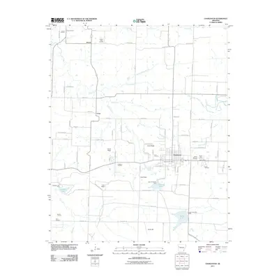
2011 Map of Charleston
USGS Topo · Published 2011About this map
Charleston serves as the central hub of this Franklin County landscape, where the southern portion of the map is dominated by the extensive boundaries of Fort Chaffee. The town's civic infrastructure is anchored by the Charleston Post Office and several community burial grounds, including the Garden Memorial Cemetery and Sacred Heart Cemetery. The surrounding countryside reveals a pattern of dispersed settlements such as Beverly, Ursula, and Grand Ridge, interconnected by a network of rural routes like Military Rd and Ursula Rd.
Find a feature on this map
75 named features on this map. Tap any name to fly to it.
Don’t see what you’re looking for? This feature index may not catch every label — zoom into the map to look around manually.
Map Details
Editions of this 2011 Charleston Map
This is the sole edition of this map. No revisions or reprints were ever made.
Other maps of this area

1887 · Magazine Mountain #2
USGS Topo · 1:62,500

1887 · Magazine Mountain #3
USGS Topo · 1:62,500

1887 · Magazine Mountain
USGS Topo · 1:62,500

1890 · Magazine Mountain
USGS Topo · 1:125,000

1890 · Fort Smith
USGS Topo · 1:125,000

1906 · Lavaca
USGS Topo · 1:62,500

1906 · Barber
USGS Topo · 1:62,500

1934 · Booneville
USGS Topo · 1:48,000

1939 · Booneville
USGS Topo · 1:62,500

1943 · Fort Smith
USGS Topo · 1:125,000