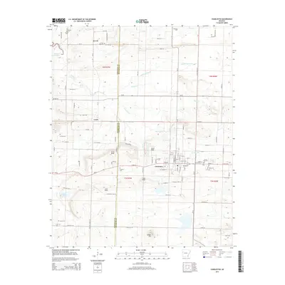
2014 Map of Charleston
USGS Topo · Published 2014About this map
Charleston serves as a focal point along the Sebastian County and Franklin County line, exhibiting a landscape defined by small-town development and rural cemeteries. The area is notable for its numerous family and community burial grounds, including the Sacred Heart Cem, Garden Memorial Cem, and Nixon Cem situated east of the town center. To the west and north, smaller settlements like Ursula and Beverly are positioned near local terrain features such as Hickory Ridge and Coal Ridge. The geography is further shaped by several watercourses like Doctors Creek and Prairie Cr, while prominent landmarks such as Potato Hill and Engineer Lake anchor the southern portion of the map. This survey illustrates the persistent agricultural and small-town structure of the region, where local roads like Military Rd and Ar-22 connect long-standing residential pockets and heritage sites.
Find a feature on this map
69 named features on this map. Tap any name to fly to it.
Don’t see what you’re looking for? This feature index may not catch every label — zoom into the map to look around manually.
Map Details
Editions of this 2014 Charleston Map
This is the sole edition of this map. No revisions or reprints were ever made.
Other maps of this area

1887 · Magazine Mountain #2
USGS Topo · 1:62,500

1887 · Magazine Mountain #3
USGS Topo · 1:62,500

1887 · Magazine Mountain
USGS Topo · 1:62,500

1890 · Magazine Mountain
USGS Topo · 1:125,000

1890 · Fort Smith
USGS Topo · 1:125,000

1906 · Lavaca
USGS Topo · 1:62,500

1906 · Barber
USGS Topo · 1:62,500

1934 · Booneville
USGS Topo · 1:48,000

1939 · Booneville
USGS Topo · 1:62,500

1943 · Fort Smith
USGS Topo · 1:125,000