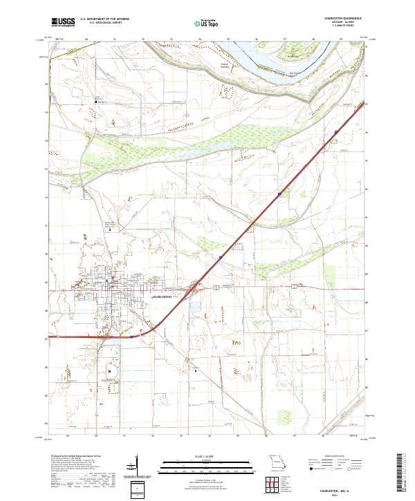
2021 Map of Charleston
USGS Topo · Published 2021About this map
The Mississippi County Courthouse stands as the central landmark of Charleston, anchor of a grid-patterned settlement defined by streets like Goodin Ave and W Marshall St. This landscape is fundamentally shaped by its relationship to the Mississippi River, which forms the boundary between Missouri and Illinois. The surrounding lowlands are crisscrossed by a complex drainage network, including the Big Lake Bayou, Wolf Hole Lateral, and Fish Lake Ditch, illustrating the extensive engineering required to manage the floodplain for agriculture.
Find a feature on this map
81 named features on this map. Tap any name to fly to it.
Don’t see what you’re looking for? This feature index may not catch every label — zoom into the map to look around manually.
Map Details
Editions of this 2021 Charleston Map
This is the sole edition of this map. No revisions or reprints were ever made.
Other maps of this area

1931 · Cairo
USGS Topo · 1:62,500

1933 · Cairo
USGS Topo · 1:62,500

1934 · Thebes
USGS Topo · 1:62,500

1939 · Wickliffe
USGS Topo · 1:62,500

1939 · Charleston
USGS Topo · 1:62,500

1939 · Cairo
USGS Topo · 1:62,500

1939 · Thebes
USGS Topo · 1:62,500

1949 · Paducah
USGS Topo · 1:250,000

1950 · Paducah
USGS Topo · 1:250,000

1951 · Wickliffe SW
USGS Topo · 1:24,000