
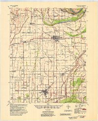
1954 Map of Charleston
USGS Topo · Published 1954About this map
The Mississippi River creates a dramatic landscape of loops and cutoffs in this region, most notably at Dog Tooth Bend. The survey reveals a highly engineered agricultural landscape defined by the Main Ditch system and extensive flood control levees. These drainage patterns support established communities like Charleston and East Prairie, which serve as central hubs for a network of rural schools and churches. The influence of the Missouri Pacific and St. Louis Southwestern railroads is evident, as they link small settlements such as Bertrand and Anniston to the wider commerce of the Bootheel.
Find a feature on this map
58 named features on this map. Tap any name to fly to it.
Don’t see what you’re looking for? This feature index may not catch every label — zoom into the map to look around manually.
Map Details
Editions of this 1954 Charleston Map
2 editions found
Other maps of this area

1931 · Sikeston
USGS Topo · 1:62,500

1931 · Cairo
USGS Topo · 1:62,500

1933 · Cairo
USGS Topo · 1:62,500

1934 · Thebes
USGS Topo · 1:62,500

1934 · Morley
USGS Topo · 1:62,500

1934 · Sikeston
USGS Topo · 1:62,500

1939 · Wickliffe
USGS Topo · 1:62,500

1939 · Sikeston
USGS Topo · 1:62,500

1939 · Charleston
USGS Topo · 1:62,500

1939 · Hickman
USGS Topo · 1:62,500