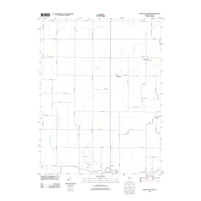
2012 Map of Charleston North
USGS Topo · Published 2012About this map
Bushton and Fairgrange anchor the landscape of northern Coles County in the early 21st century, surrounded by a complex network of county roads and drainage systems. This agrarian region is defined by its water management, most notably the extensive Union Drainage District Number 3 and numerous named tributaries like Greasy Cr, Flat Br, and Cassell Cr. For genealogists, the map is particularly valuable for its documentation of local burial grounds, including the Mound Cem, Winkleblack Cem, and Cossel Cem. These sites, along with others like Salem Cem and Roselawn Cem, provide fixed points for tracing family history across the rural Illinois prairie. The grid of roads, such as Decker Springs Rd and Co Rd 1500N, reflects the enduring section-line organization of the Midwest.
Find a feature on this map
74 named features on this map. Tap any name to fly to it.
Don’t see what you’re looking for? This feature index may not catch every label — zoom into the map to look around manually.
Map Details
Editions of this 2012 Charleston North Map
This is the sole edition of this map. No revisions or reprints were ever made.
Other maps of this area

1933 · Toledo
USGS Topo · 1:62,500

1934 · Mattoon
USGS Topo · 1:62,500

1935 · Arcola
USGS Topo · 1:48,000

1936 · Oakland
USGS Topo · 1:48,000

1937 · Mattoon
USGS Topo · 1:62,500

1938 · Toledo
USGS Topo · 1:62,500

1940 · Arcola
USGS Topo · 1:62,500

1942 · Oakland
USGS Topo · 1:62,500

1958 · Decatur
USGS Topo · 1:250,000

1961 · Decatur
USGS Topo · 1:250,000