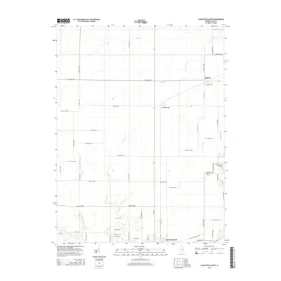
2015 Map of Charleston North
USGS Topo · Published 2015About this map
Charleston and its northern surroundings are defined by an expansive grid of county roads and a network of drainage systems essential to this agricultural landscape. The area is marked by numerous family-named burial grounds including Winkleblack Cem, Craig Cem, and Cossel Cem, which serve as vital landmarks for local family history and genealogy. The topography is shaped by several watercourses like Greasy Cr and Cassell Cr, along with the formal infrastructure of the Union Drainage District Number 3. Small settlements such as Bushton and Fairgrange punctuate the intersections of long county roads, maintaining their identity as rural centers in the mid-2010s. The map illustrates the persistent intersection of natural creek beds and modern engineering, where traditional landmarks like Mound Cem and Roselawn Cem sit amidst a carefully managed prairie environment.
Find a feature on this map
55 named features on this map. Tap any name to fly to it.
Don’t see what you’re looking for? This feature index may not catch every label — zoom into the map to look around manually.
Map Details
Editions of this 2015 Charleston North Map
This is the sole edition of this map. No revisions or reprints were ever made.
Other maps of this area

1933 · Toledo
USGS Topo · 1:62,500

1934 · Mattoon
USGS Topo · 1:62,500

1935 · Arcola
USGS Topo · 1:48,000

1936 · Oakland
USGS Topo · 1:48,000

1937 · Mattoon
USGS Topo · 1:62,500

1938 · Toledo
USGS Topo · 1:62,500

1940 · Arcola
USGS Topo · 1:62,500

1942 · Oakland
USGS Topo · 1:62,500

1958 · Decatur
USGS Topo · 1:250,000

1961 · Decatur
USGS Topo · 1:250,000