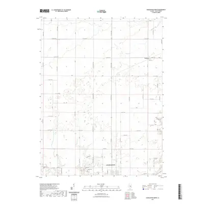
2021 Map of Charleston North
USGS Topo · Published 2021About this map
The northern edge of Charleston and its surrounding agricultural plains are revealed in this modern topographic survey, showing a landscape defined by a grid of rural routes and small watercourses. Family history researchers will find several notable burial grounds, including Roselawn Cem, Mound Cem, and Salem Cem situated along the city's periphery. To the northeast, the small settlement of Bushton sits at the junction of South St and West St, surrounded by the drainage basins of Greasy Cr and Flat Br. The map also documents the complex local hydrography, featuring the engineered path of Union Drainage District Number 3 alongside natural runs like Cassell Cr and Riley Cr. This 2021 edition provides a detailed look at the interface between Illinois' rural road network, such as Decker Springs Rd, and the expansion of the Coles County seat.
Find a feature on this map
50 named features on this map. Tap any name to fly to it.
Don’t see what you’re looking for? This feature index may not catch every label — zoom into the map to look around manually.
Map Details
Editions of this 2021 Charleston North Map
This is the sole edition of this map. No revisions or reprints were ever made.
Other maps of this area

1933 · Toledo
USGS Topo · 1:62,500

1934 · Mattoon
USGS Topo · 1:62,500

1935 · Arcola
USGS Topo · 1:48,000

1936 · Oakland
USGS Topo · 1:48,000

1937 · Mattoon
USGS Topo · 1:62,500

1938 · Toledo
USGS Topo · 1:62,500

1940 · Arcola
USGS Topo · 1:62,500

1942 · Oakland
USGS Topo · 1:62,500

1958 · Decatur
USGS Topo · 1:250,000

1961 · Decatur
USGS Topo · 1:250,000