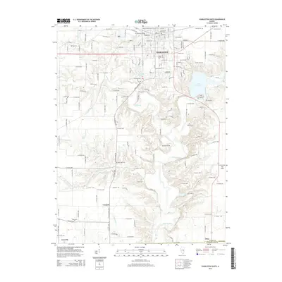
2015 Map of Charleston South
USGS Topo · Published 2015About this map
Charleston anchor the northern landscape of this Illinois survey, where the campus of Eastern Illinois Univ meets the residential grid at the edge of the Embarras River valley. The terrain transitions from the urbanized reaches of Glenwood Lake and Lake Charleston into a rural expanse defined by complex drainage systems, including Kickapoo Cr and N Fork Indian Cr. Genealogists will find a high density of small burial grounds across the countryside, such as Mount Tabor Cem, Old Charleston Cem, and the family-named McKenzie Cem. Small settlements like Campbell and Janesville are situated along the south-reaching roads, while the border between Coles County and Cumberland County cuts through the southern edge near the community of Diona. The map illustrates a landscape of balanced growth, where modern infrastructure intersects with older rural landmarks and significant water features like Ridge Lake.
Find a feature on this map
92 named features on this map. Tap any name to fly to it.
Don’t see what you’re looking for? This feature index may not catch every label — zoom into the map to look around manually.
Map Details
Editions of this 2015 Charleston South Map
This is the sole edition of this map. No revisions or reprints were ever made.
Other maps of this area

1933 · Toledo
USGS Topo · 1:62,500

1934 · Mattoon
USGS Topo · 1:62,500

1935 · Arcola
USGS Topo · 1:48,000

1936 · Oakland
USGS Topo · 1:48,000

1937 · Mattoon
USGS Topo · 1:62,500

1938 · Toledo
USGS Topo · 1:62,500

1940 · Arcola
USGS Topo · 1:62,500

1942 · Oakland
USGS Topo · 1:62,500

1958 · Decatur
USGS Topo · 1:250,000

1961 · Decatur
USGS Topo · 1:250,000