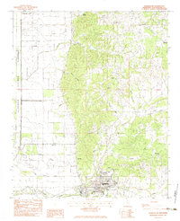
1982 Map of Charleston
USGS Topo · Published 1983About this map
Charleston serves as the focal point of this Tallahatchie County landscape, where the transition from the alluvial delta plains to the rising eastern hills is clearly defined. The western portion of the sheet is dominated by a systematic drainage network including Robinson Bayou and a prominent floodway near the Quitman Panola line. This hydrologic pattern reflects the region's historical efforts to manage the water of the Yazoo Basin for agriculture.
Find a feature on this map
34 named features on this map. Tap any name to fly to it.
Don’t see what you’re looking for? This feature index may not catch every label — zoom into the map to look around manually.
Map Details
Editions of this 1982 Charleston Map
This is the sole edition of this map. No revisions or reprints were ever made.
Other maps of this area

1932 · Philipp
USGS Topo · 1:48,000

1935 · Crowder
USGS Topo · 1:62,500

1935 · Philipp
USGS Topo · 1:62,500

1939 · Crowder
USGS Topo · 1:62,500

1939 · Philipp
USGS Topo · 1:62,500

1948 · Helena
USGS Topo · 1:250,000

1950 · Helena
USGS Topo · 1:250,000

1953 · Greenwood
USGS Topo · 1:250,000

1953 · West Point
USGS Topo · 1:250,000

1954 · Grenada
USGS Topo · 1:62,500