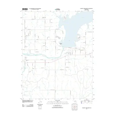
2012 Map of Charley Creek West
USGS Topo · Published 2012About this map
Kaw Lake dominates the northeastern landscape of this Kay County region, its irregular shoreline forming prominent features like Ponca Cove and McFadden Cove. The surrounding terrain is a mix of agricultural plots and energy production sites, most notably the Hardy Oil Field and North Drum Oil Field. For those tracing local family history, the map identifies significant burial sites including Longwood Cem and Sunset Memorial Gardens, providing precise locations for genealogical research. The infrastructure of the early 21st century is well-documented here, from the small Thomas Landing Airport to a network of named rural roads like E Hartford Ave and N Enterprise Rd. Creeks such as Prettyhair Cr and Little Drum Cr drain the southern prairies, illustrating the natural drainage patterns that shaped the placement of early homesteads and modern transport routes alike.
Find a feature on this map
85 named features on this map. Tap any name to fly to it.
Don’t see what you’re looking for? This feature index may not catch every label — zoom into the map to look around manually.
Map Details
Editions of this 2012 Charley Creek West Map
This is the sole edition of this map. No revisions or reprints were ever made.
Other maps of this area

1935 · Kaw
USGS Topo · 1:62,500

1936 · Belford
USGS Topo · 1:62,500

1955 · Enid
USGS Topo · 1:250,000

1958 · Enid
USGS Topo · 1:250,000

1963 · Charley Creek
USGS Topo · 1:24,000

1963 · Uncas
USGS Topo · 1:24,000

1964 · Charley Creek NE
USGS Topo · 1:24,000

1964 · Kaw City
USGS Topo · 1:24,000

1968 · Ponca City SE
USGS Topo · 1:24,000

1968 · Kildare
USGS Topo · 1:24,000