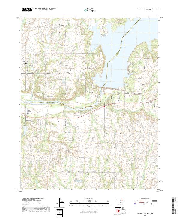
2022 Map of Charley Creek West
USGS Topo · Published 2022About this map
Kaw Lake and the Arkansas River dominate this modern landscape where the borders of Kay and Osage counties meet. The eastern edge of Ponca City is visible, transitioning from residential streets like Hartford Ave into the rural outskirts. Two significant burial grounds, Longwood Cem and Sunset Memorial Gardens Cem, serve as important landmarks for genealogists researching local families. To the north, Thomas Landing sits near the shore, while the interior is marked by a network of creeks including Coon Creek and Charley Cr. The topography reveals the complex water management of the region, evidenced by the Burlingame Number 1 Reservoir and several unnamed utility reservoirs. Local transit is defined by rural routes such as Kaw Dam Rd and N Enterprise Rd, which navigate the varying elevations above the river basin.
Find a feature on this map
76 named features on this map. Tap any name to fly to it.
Don’t see what you’re looking for? This feature index may not catch every label — zoom into the map to look around manually.
Map Details
Editions of this 2022 Charley Creek West Map
This is the sole edition of this map. No revisions or reprints were ever made.
Other maps of this area

1935 · Kaw
USGS Topo · 1:62,500

1936 · Belford
USGS Topo · 1:62,500

1955 · Enid
USGS Topo · 1:250,000

1958 · Enid
USGS Topo · 1:250,000

1963 · Charley Creek
USGS Topo · 1:24,000

1963 · Uncas
USGS Topo · 1:24,000

1964 · Charley Creek NE
USGS Topo · 1:24,000

1964 · Kaw City
USGS Topo · 1:24,000

1968 · Ponca City SE
USGS Topo · 1:24,000

1968 · Kildare
USGS Topo · 1:24,000