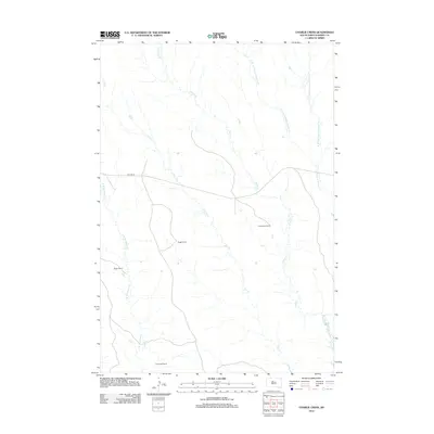
2012 Map of Charlie Creek
USGS Topo · Published 2012About this map
Ducheneau Ranch and Sogge Ranch stand as prominent landmarks in this ranching landscape within the Cheyenne River Indian Reservation. The map documents a sparsely settled portion of Dewey County defined by the drainage networks of Charlie Cr and Fox Cr, which carve through the high plains. Movement through the region is anchored by Bia Hwy 8, the primary artery connecting these isolated homesteads. The naming of operations such as Wager Ranch and Dog Eagle Ranch reflects the enduring agricultural and indigenous heritage of the area. These family-named ranch sites provide essential points of reference for genealogists and local historians tracking the modern footprint of land use in South Dakota’s West River country.
Find a feature on this map
11 named features on this map. Tap any name to fly to it.
Don’t see what you’re looking for? This feature index may not catch every label — zoom into the map to look around manually.
Map Details
Editions of this 2012 Charlie Creek Map
This is the sole edition of this map. No revisions or reprints were ever made.
Other maps of this area

1953 · McIntosh
USGS Topo · 1:250,000

1954 · Pierre
USGS Topo · 1:250,000

1956 · Rousseau Creek SW
USGS Topo · 1:24,000

1958 · Pierre
USGS Topo · 1:250,000

1958 · McIntosh
USGS Topo · 1:250,000

1969 · Rousseau Creek
USGS Topo · 1:24,000

1969 · No Heart Creek SW
USGS Topo · 1:24,000

1981 · Charlie Creek
USGS Topo · 1:24,000

1981 · Rousseau Creek NW
USGS Topo · 1:24,000
1981 · No Heart Creek
USGS Topo · 1:24,000