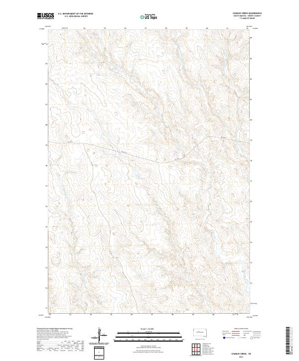
2021 Map of Charlie Creek
USGS Topo · Published 2021About this map
The drainage basins of Charlie Cr and its tributaries define this landscape in Dewey County, where the high plains are carved by seasonal watercourses. This modern survey illustrates the sparse, rural infrastructure typical of the region, anchored by the passage of BIA Hwy 8 and 261 Ave. The topography reveals the intricate network of the Tall Prairie Chicken Cr system, including both its W Br and E Br forks. In the southwestern portion of the map, the headwaters of E Br Rousseau Cr and the winding path of Fox Cr highlight the erosion patterns across the prairie. The lack of concentrated settlements underscores the vast, open nature of this territory, which remains dominated by ranching and natural drainage features.
Find a feature on this map
12 named features on this map. Tap any name to fly to it.
Don’t see what you’re looking for? This feature index may not catch every label — zoom into the map to look around manually.
Map Details
Editions of this 2021 Charlie Creek Map
This is the sole edition of this map. No revisions or reprints were ever made.
Other maps of this area

1953 · McIntosh
USGS Topo · 1:250,000

1954 · Pierre
USGS Topo · 1:250,000

1956 · Rousseau Creek SW
USGS Topo · 1:24,000

1958 · Pierre
USGS Topo · 1:250,000

1958 · McIntosh
USGS Topo · 1:250,000

1969 · Rousseau Creek
USGS Topo · 1:24,000

1969 · No Heart Creek SW
USGS Topo · 1:24,000

1981 · Charlie Creek
USGS Topo · 1:24,000

1981 · Rousseau Creek NW
USGS Topo · 1:24,000
1981 · No Heart Creek
USGS Topo · 1:24,000