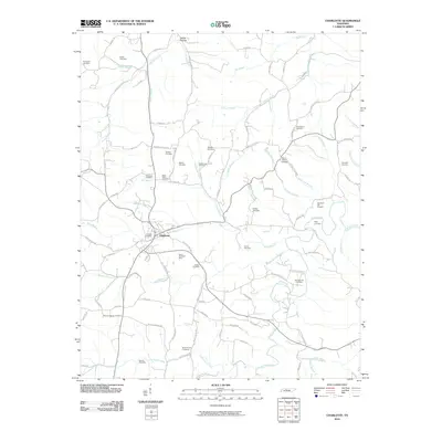
2010 Map of Charlotte
USGS Topo · Published 2010About this map
Charlotte serves as the central hub of this Tennessee landscape, surrounded by a dense network of family cemeteries and rural landmarks that speak to generations of local settlement. The terrain is defined by the winding paths of Sulphur Fork Creek and Jones Creek, which carve through the countryside alongside numerous smaller tributaries like Bartons Creek and Nesbitt Branch. The map reveals a history of resource extraction, notably at the South Charlotte Mine and the Ore Bank Hill Prospect located near Peabody Branch.
Find a feature on this map
99 named features on this map. Tap any name to fly to it.
Don’t see what you’re looking for? This feature index may not catch every label — zoom into the map to look around manually.
Map Details
Editions of this 2010 Charlotte Map
This is the sole edition of this map. No revisions or reprints were ever made.
Other maps of this area

1930 · White Bluff
USGS Topo · 1:62,500

1933 · White Bluff
USGS Topo · 1:62,500

1936 · Burns
USGS Topo · 1:24,000

1936 · Dickson
USGS Topo · 1:24,000

1953 · Dickson
USGS Topo · 1:24,000

1953 · Burns
USGS Topo · 1:24,000

1956 · Nashville
USGS Topo · 1:250,000

1957 · Cheatham Dam
USGS Topo · 1:24,000

1958 · Charlotte
USGS Topo · 1:24,000

1958 · Cumberland Furnace
USGS Topo · 1:24,000