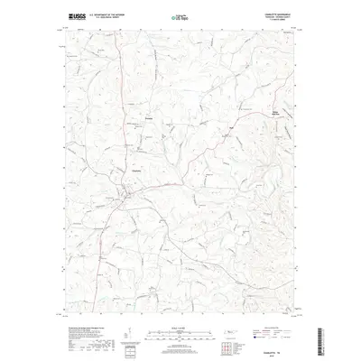
2019 Map of Charlotte
USGS Topo · Published 2019About this map
The county seat of Charlotte serves as the focal point of this Dickson County landscape, where the historic courthouse area is bounded by Town Br and Town Branch Rd. The surrounding terrain is defined by a dense network of creek branches and hollows, including Harris Hollow and Lower Forge Hollow, which dictated the winding paths of early routes like Stage Rd and Old State Hwy 47. This survey preserves the locations of numerous family and community burial grounds, such as Hickerson Cem, Nesbitt Cem, and Roberts Cem, many associated with rural crossroads like Promise and Dull. The density of these small cemeteries, including Rock Church Cem and Saint Pauls Cem, provides a detailed record of the long-standing settlement patterns in the Tennessee hills before the modern era's consolidation.
Find a feature on this map
126 named features on this map. Tap any name to fly to it.
Don’t see what you’re looking for? This feature index may not catch every label — zoom into the map to look around manually.
Map Details
Editions of this 2019 Charlotte Map
This is the sole edition of this map. No revisions or reprints were ever made.
Other maps of this area

1930 · White Bluff
USGS Topo · 1:62,500

1933 · White Bluff
USGS Topo · 1:62,500

1936 · Burns
USGS Topo · 1:24,000

1936 · Dickson
USGS Topo · 1:24,000

1953 · Dickson
USGS Topo · 1:24,000

1953 · Burns
USGS Topo · 1:24,000

1956 · Nashville
USGS Topo · 1:250,000

1957 · Cheatham Dam
USGS Topo · 1:24,000

1958 · Charlotte
USGS Topo · 1:24,000

1958 · Cumberland Furnace
USGS Topo · 1:24,000