
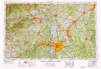
1953 Map of Charlotte
USGS Topo · Published 1968About this map
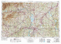
Charlotte stands as the primary urban hub in a region defined by the expansive Catawba River and Yadkin River drainage basins. This mid-century landscape shows the Piedmont in a state of transition, as the recently filled Lake Norman becomes a dominant geographical feature alongside older reservoirs like Lake James and High Rock Lake. A dense network of rail lines, including the Southern Railway and the Seaboard Air Line Railroad, connects established manufacturing and textile centers such as Gastonia, Concord, and Hickory.
Find a feature on this map
198 named features on this map. Tap any name to fly to it.
Don’t see what you’re looking for? This feature index may not catch every label — zoom into the map to look around manually.
Map Details
Editions of this 1953 Charlotte Map
3 editions found
Other maps of this area

1889 · Wilkesboro
USGS Topo · 1:125,000

1891 · Roan Mountain
USGS Topo · 1:125,000

1891 · Wilkesboro
USGS Topo · 1:125,000

1891 · Yadkinville
USGS Topo · 1:125,000

1893 · Cranberry
USGS Topo · 1:125,000

1893 · Statesville
USGS Topo · 1:125,000

1893 · Yadkinville
USGS Topo · 1:125,000

1894 · Roan Mountain
USGS Topo · 1:125,000

1895 · Hickory
USGS Topo · 1:125,000

1895 · Cranberry
USGS Topo · 1:125,000