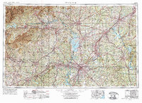
1953 Map of Charlotte
USGS Topo · Published 1975About this map
Charlotte serves as the metropolitan hub of this 1970s revision, which illustrates the Piedmont region’s rapid integration via the burgeoning interstate system. The construction of Lake Norman on the Catawba River has transformed the landscape north of Mecklenburg County, creating a massive reservoir where riverbeds once ran. To the west, the Blue Ridge Mountains and Pisgah National Forest rise sharply, providing a topographical contrast to the industrial corridors of Gastonia and Concord.
Find a feature on this map
91 named features on this map. Tap any name to fly to it.
Don’t see what you’re looking for? This feature index may not catch every label — zoom into the map to look around manually.
Map Details
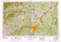
Editions of this 1953 Charlotte Map
3 editions found

Other maps of this area

1889 · Wilkesboro
USGS Topo · 1:125,000

1891 · Roan Mountain
USGS Topo · 1:125,000

1891 · Wilkesboro
USGS Topo · 1:125,000

1891 · Yadkinville
USGS Topo · 1:125,000

1893 · Cranberry
USGS Topo · 1:125,000

1893 · Statesville
USGS Topo · 1:125,000

1893 · Yadkinville
USGS Topo · 1:125,000

1894 · Roan Mountain
USGS Topo · 1:125,000

1895 · Hickory
USGS Topo · 1:125,000

1895 · Cranberry
USGS Topo · 1:125,000