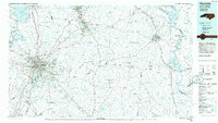
1985 Map of Charlotte
USGS Topo · Published 1986About this map
Charlotte stands as the central hub of this mid-1980s regional survey, showing the city's significant expansion toward satellite communities like Matthews, Mint Hill, and Huntersville. The landscape is defined by its educational and industrial landmarks, from Davidson College in the north to the Charlotte Motor Speedway near Harrisburg. The map captures the Piedmont region during a period of transition, where established rail lines like the Southern Railway and Seaboard System Railroad intersect with the burgeoning interstate network of Interstate 77 and Interstate 85.
Find a feature on this map
200 named features on this map. Tap any name to fly to it.
Don’t see what you’re looking for? This feature index may not catch every label — zoom into the map to look around manually.
Map Details
Editions of this 1985 Charlotte Map
2 editions found
Other maps of this area

1893 · Statesville
USGS Topo · 1:125,000

1895 · Hickory
USGS Topo · 1:125,000

1905 · Charlotte
USGS Topo · 1:48,000

1907 · Charlotte
USGS Topo · 1:62,500

1914 · Gastonia
USGS Topo · 1:48,000

1916 · Gastonia
USGS Topo · 1:62,500

1941 · Charlotte
USGS Topo · 1:125,000

1941 · Spartanburg
USGS Topo · 1:250,000

1942 · Troy
USGS Topo · 1:125,000

1942 · Charlotte
USGS Topo · 1:125,000