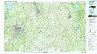
1985 Map of Charlotte
USGS Topo · Published 1991About this map
Charlotte anchors this mid-1980s landscape, positioned as a regional hub where the Southern Railway and Seaboard System converge with the modern infrastructure of Interstate 85 and Interstate 77. To the east, the terrain transitions from the suburban growth of Matthews and Mint Hill to the rural expanses of the Uwharrie Mountains. A significant historical landmark is the Reed Gold Mine, marking the site of the first documented gold find in the United States.
Find a feature on this map
70 named features on this map. Tap any name to fly to it.
Don’t see what you’re looking for? This feature index may not catch every label — zoom into the map to look around manually.
Map Details
Editions of this 1985 Charlotte Map
2 editions found
Other maps of this area

1893 · Statesville
USGS Topo · 1:125,000

1895 · Hickory
USGS Topo · 1:125,000

1905 · Charlotte
USGS Topo · 1:48,000

1907 · Charlotte
USGS Topo · 1:62,500

1914 · Gastonia
USGS Topo · 1:48,000

1916 · Gastonia
USGS Topo · 1:62,500

1941 · Charlotte
USGS Topo · 1:125,000

1941 · Spartanburg
USGS Topo · 1:250,000

1942 · Troy
USGS Topo · 1:125,000

1942 · Charlotte
USGS Topo · 1:125,000