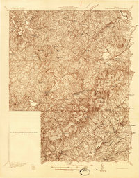
1935 Map of Charlottesville
USGS Topo · Published 1935About this map
The South Fork Rivanna River system anchors this 1935 survey, where the rolling piedmont of Albemarle County meets the foothills of the Blue Ridge. The landscape is defined by a dense network of rural infrastructure, including numerous small community schools like Mountain View Sch and Advance Mills Sch, alongside central gathering points such as Mountain Chapel and Chestnut Grove Ch. Transportation in the mid-1930s relied on the intersection of established rail lines and local river crossings. The Southern Railway passes through Barboursville, while the Chesapeake and Ohio serves the southern portions of the quadrangle near Keswick. Higher elevations are marked by distinctive landmarks such as Piney Mtn and Sugar Loaf Mtn, which overlook the winding paths of Buck Mountain Creek and Preddy Creek.
Find a feature on this map
52 named features on this map. Tap any name to fly to it.
Don’t see what you’re looking for? This feature index may not catch every label — zoom into the map to look around manually.
Map Details
Editions of this 1935 Charlottesville Map
2 editions found

Other maps of this area

1891 · Palmyra
USGS Topo · 1:125,000

1892 · Buckingham
USGS Topo · 1:125,000

1892 · Gordonsville
USGS Topo · 1:125,000

1892 · Harrisonburg
USGS Topo · 1:125,000

1895 · Palmyra
USGS Topo · 1:125,000

1897 · Palmyra
USGS Topo · 1:125,000

1929 · Covesville
USGS Topo · 1:62,500

1930 · Madison
USGS Topo · 1:48,000

1931 · University
USGS Topo · 1:62,500

1933 · Madison
USGS Topo · 1:62,500