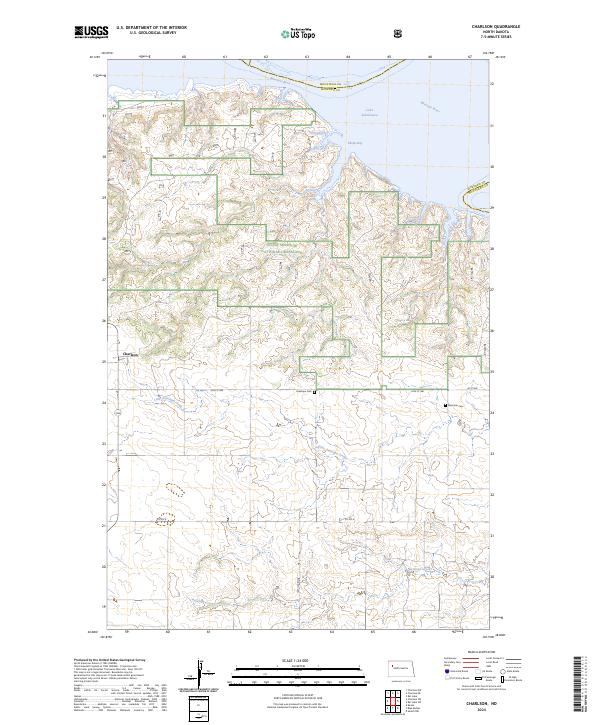
2024 Map of Charlson
USGS Topo · Published 2024About this map
Little Missouri National Grassland dominates the northern reaches of this McKenzie County landscape, where the rugged breaks meet the expansive waters of Lake Sakakawea. The topography is defined by the incision of Little Antelope Creek and Antelope Creek as they drain toward the Missouri River valley. The small settlement of Charlson serves as a local point of reference in an area otherwise characterized by section lines and remote ranching infrastructure. Cultural history is anchored by the presence of Antelope Cem and Riverside Cem, which offer significant value for genealogists tracing early families in this part of North Dakota. These sites, along with features like Phelps Bay, illustrate the intersection of the natural badlands environment with the modern shoreline created by regional water management.
Find a feature on this map
21 named features on this map. Tap any name to fly to it.
Don’t see what you’re looking for? This feature index may not catch every label — zoom into the map to look around manually.
Map Details
Editions of this 2024 Charlson Map
This is the sole edition of this map. No revisions or reprints were ever made.
Other maps of this area

1953 · Williston
USGS Topo · 1:250,000

1953 · Watford City
USGS Topo · 1:250,000

1957 · Williston
USGS Topo · 1:250,000

1957 · Watford City
USGS Topo · 1:250,000

1965 · Keene
USGS Topo · 1:24,000

1965 · Charlson
USGS Topo · 1:24,000

1965 · Blue Buttes
USGS Topo · 1:24,000

1965 · Charlson SW
USGS Topo · 1:24,000

1965 · Charlson NE
USGS Topo · 1:24,000

1965 · Charlson NW
USGS Topo · 1:24,000