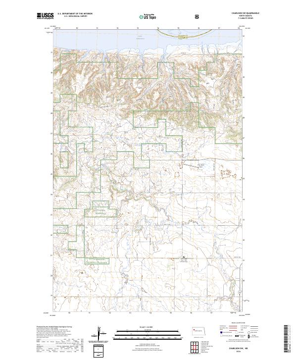
2024 Map of Charlson SW
USGS Topo · Published 2024About this map
Little Missouri National Grassland dominates the broken landscape of McKenzie County in this contemporary survey, characterized by the intricate drainages of Sand Creek and its tributaries. The northern boundary is defined by the expansive waters of Lake Sakakawea, which significantly altered the local geography and road networks after its creation. The map provides a clear look at the intersection of rural life and public land management, showing how modern transportation routes like State Hwy 1806 and Co Rd 55 navigate the high plateaus and coulees. A small cluster of historical significance appears in the south at Good Hope Cem - First Lutheran Cem, serving as a vital landmark for genealogists and local historians tracking early 20th-century settlement patterns. The presence of Prop Wash Field further highlights the utilitarian use of this open, windswept terrain.
Find a feature on this map
24 named features on this map. Tap any name to fly to it.
Don’t see what you’re looking for? This feature index may not catch every label — zoom into the map to look around manually.
Map Details
Editions of this 2024 Charlson SW Map
This is the sole edition of this map. No revisions or reprints were ever made.
Other maps of this area

1911 · Ray
USGS Topo · 1:125,000

1953 · Williston
USGS Topo · 1:250,000

1953 · Watford City
USGS Topo · 1:250,000

1957 · Williston
USGS Topo · 1:250,000

1957 · Watford City
USGS Topo · 1:250,000

1965 · Keene
USGS Topo · 1:24,000

1965 · Charlson
USGS Topo · 1:24,000

1965 · Blue Buttes
USGS Topo · 1:24,000

1965 · Charlson SW
USGS Topo · 1:24,000

1965 · Charlson NE
USGS Topo · 1:24,000