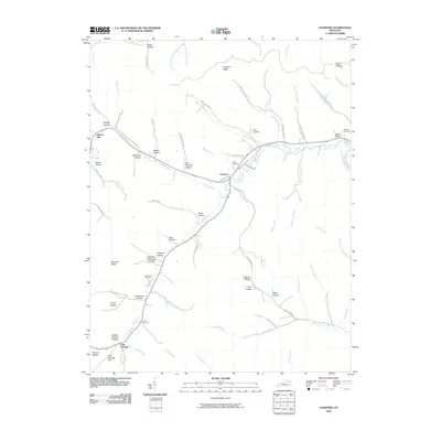
2010 Map of Charters
USGS Topo · Published 2010About this map
Glen Springs and the village of Charters anchor this topographic view of the Lewis County landscape, where the terrain is defined by an intricate network of hollows and ridges. The map reveals a deeply etched drainage pattern, with Salt Lick Creek and Big Branch serving as the primary arteries for dozens of smaller tributaries like Esham Branch and Little Sulphur Branch. Genealogists will find significant value in the documentation of several family-named burial sites and landmarks, including McCoy Cemetery, Webster Cemetery, and the strikingly named Big John Hackworth Hollow. The transition from the higher elevations of Kentucky Ridge to the low-lying settlements along Old Rte 10 illustrates the historical reliance on creek valleys for transport and habitation. From the northern reaches of Pleasant Ridge to the southern slopes of Glen Springs Hill, the map provides a precise record of rural Kentucky's spatial organization at the beginning of the twenty-first century.
Find a feature on this map
73 named features on this map. Tap any name to fly to it.
Don’t see what you’re looking for? This feature index may not catch every label — zoom into the map to look around manually.
Map Details
Editions of this 2010 Charters Map
This is the sole edition of this map. No revisions or reprints were ever made.
Other maps of this area

1919 · Vanceburg
USGS Topo · 1:62,500

1929 · Springdale
USGS Topo · 1:48,000

1935 · Springdale
USGS Topo · 1:62,500

1949 · Vanceburg
USGS Topo · 1:62,500

1949 · Buena Vista
USGS Topo · 1:24,000

1949 · Vanceburg
USGS Topo · 1:24,000

1949 · Concord
USGS Topo · 1:24,000

1949 · Charters
USGS Topo · 1:24,000

1950 · Charters
USGS Topo · 1:24,000

1950 · Head Of Grassy
USGS Topo · 1:24,000