
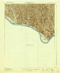
1919 Map of Vanceburg
USGS Topo · Published 1938About this map
The Ohio River shoreline forms the primary axis of this 1915 survey, where the border between Ohio and Kentucky is defined by the moving waters of the river corridor. Small agricultural and riverfront communities such as Rome and Stout PO are centered along the northern bank, supported by a dense network of country schools including the McGovney School, Nesbitt School, and Russell School. The topography is defined by sharp ridges and deep incisions, with features like Southdown Ridge and Blackbury Ridge separating numerous hollows, such as Demazie Hollow and Silvermine Hollow. This edition reveals the high density of rural education in the early twentieth century, with over a dozen named schools serving the scattered populations along Brush Creek and its many tributaries. The southeastern portion of the map remains a Preliminary Edition Unsurveyed Area, reflecting the transitional state of topographical mapping during this period.
Find a feature on this map
67 named features on this map. Tap any name to fly to it.
Don’t see what you’re looking for? This feature index may not catch every label — zoom into the map to look around manually.
Map Details
Editions of this 1919 Vanceburg Map
2 editions found
Other maps of this area

1915 · Garrison
USGS Topo · 1:62,500

1915 · Otway
USGS Topo · 1:62,500

1916 · Peebles
USGS Topo · 1:62,500

1917 · Otway
USGS Topo · 1:62,500

1918 · Garrison
USGS Topo · 1:62,500

1918 · Peebles
USGS Topo · 1:62,500

1918 · Seaman
USGS Topo · 1:62,500

1929 · Springdale
USGS Topo · 1:48,000

1935 · Springdale
USGS Topo · 1:62,500

1949 · Pond Run
USGS Topo · 1:24,000