
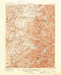
1918 Map of Peebles
USGS Topo · Published 1941About this map
Ohio Brush Creek and its many winding tributaries define this portion of the Appalachian Foothills during the early twentieth century. The landscape is characterized by a high density of rural schoolhouses and small crossroads settlements, reflecting a deeply localized social structure. Places like Marble Furnace and Steam Furnace School point to the area’s early industrial heritage, while the Norfolk and Western RR provides the primary connection for the village of Peebles. Higher elevations such as Peach Mtn and Fine Knob rise above the stream-cut valleys, and notable natural features like Buzzardroost Rock overlook the winding waters. The abundance of named schools, including Tater Ridge School and Hoop Ridge School, alongside cemeteries and rural churches like Antioch School, offers a detailed view of the community footprint before mid-century consolidation changed the rural educational landscape.
Find a feature on this map
106 named features on this map. Tap any name to fly to it.
Don’t see what you’re looking for? This feature index may not catch every label — zoom into the map to look around manually.
Map Details
Editions of this 1918 Peebles Map
2 editions found
Other maps of this area

1915 · Bainbridge
USGS Topo · 1:48,000

1915 · Garrison
USGS Topo · 1:62,500

1915 · Otway
USGS Topo · 1:62,500

1915 · Piketon
USGS Topo · 1:62,500

1916 · Peebles
USGS Topo · 1:62,500

1917 · Bainbridge
USGS Topo · 1:62,500

1917 · Piketon
USGS Topo · 1:62,500

1917 · Hillsboro
USGS Topo · 1:62,500

1917 · Otway
USGS Topo · 1:62,500

1918 · Garrison
USGS Topo · 1:62,500