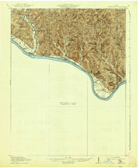
1919 Map of Vanceburg
USGS Topo · Published 1938About this map
The Ohio River forms the southern boundary of this 1915 survey, separating Adams Co, Ohio, from Kentucky before the river's path was significantly altered by modern lock and dam systems. The landscape is defined by deep drainage hollows like Corn Hollow and Rube Hollow, which feed into larger water bodies such as Brush Creek. Settlement is concentrated near the riverfront at places like Sandy Springs and Buena Vista, while the interior remains a dense network of upland ridges and small rural centers. The distribution of schools—ranging from Needmore School to Beasley Fork School—reveals a decentralized, agrarian society where education was localized within each hollow or ridge community. One notable landmark is Cedar College Ch, which suggests an early center of community life in the hills of Jefferson township. At the river's edge, the Rome Stout PO and Rockville serve as primary points of contact for the river-based trade that still dominated the local economy during this era.
Find a feature on this map
45 named features on this map. Tap any name to fly to it.
Don’t see what you’re looking for? This feature index may not catch every label — zoom into the map to look around manually.
Map Details
Editions of this 1919 Vanceburg Map
2 editions found
Other maps of this area

1915 · Garrison
USGS Topo · 1:62,500

1915 · Otway
USGS Topo · 1:62,500

1916 · Peebles
USGS Topo · 1:62,500

1917 · Otway
USGS Topo · 1:62,500

1918 · Garrison
USGS Topo · 1:62,500

1918 · Peebles
USGS Topo · 1:62,500

1918 · Seaman
USGS Topo · 1:62,500

1919 · Vanceburg
USGS Topo · 1:62,500

1929 · Springdale
USGS Topo · 1:48,000

1935 · Springdale
USGS Topo · 1:62,500