
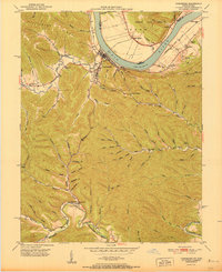
1950 Map of Charters
USGS Topo · Published 1950About this map
Salt Lick Creek and the sprawling ridges of Pleasant Ridge define the landscape of Lewis County in this 1950 survey. The settlement of Charters sits centrally at a junction of valley roads, while Clarksburg anchors the eastern edge of the sheet. The terrain is marked by a dense network of family-named hollows and branches, such as Shaw Hollow and Big John Hackworth Hollow, reflecting a deeply established rural community.
Find a feature on this map
78 named features on this map. Tap any name to fly to it.
Don’t see what you’re looking for? This feature index may not catch every label — zoom into the map to look around manually.
Map Details
Editions of this 1950 Charters Map
This is the sole edition of this map. No revisions or reprints were ever made.
Other maps of this area

1919 · Vanceburg
USGS Topo · 1:62,500

1929 · Springdale
USGS Topo · 1:48,000

1935 · Springdale
USGS Topo · 1:62,500

1949 · Vanceburg
USGS Topo · 1:62,500

1949 · Buena Vista
USGS Topo · 1:24,000

1949 · Vanceburg
USGS Topo · 1:24,000

1949 · Concord
USGS Topo · 1:24,000

1949 · Charters
USGS Topo · 1:24,000

1950 · Head Of Grassy
USGS Topo · 1:24,000
1951 · Vanceburg
USGS Topo · 1:24,000