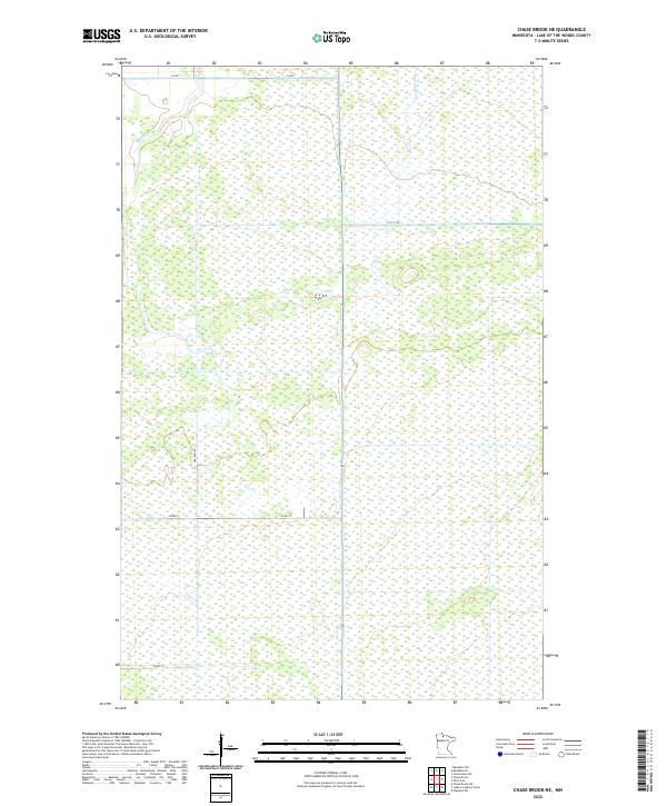
2022 Map of Chase Brook NE
USGS Topo · Published 2022About this map
Moose Cr and Bortons Brook define the hydrologic character of this remote wetland landscape in the northern reaches of Lake of the Woods County. The terrain is dominated by vast tracts of bog and lowland forest, intersected by a sparse grid of section lines and secondary roads. The northern boundary is traced by Co Rd 1, providing a primary artery through the swampy flats, while Co Rd 77 cuts across the southern portions. This 2022 survey illustrates the modern Public Land Survey System divisions, including t158n r31w, reflecting the organized township and range structure used to manage these northern Minnesota wilderness areas. The map is a testament to the persistent wildness of the region, where named water features like Moose Cr are the primary landmarks in an otherwise uniform topography.
Find a feature on this map
10 named features on this map. Tap any name to fly to it.
Don’t see what you’re looking for? This feature index may not catch every label — zoom into the map to look around manually.
Map Details
Editions of this 2022 Chase Brook NE Map
This is the sole edition of this map. No revisions or reprints were ever made.
Other maps of this area

1919 · Knutson
USGS Topo · 1:62,500

1921 · Baudette
USGS Topo · 1:62,500

1954 · Roseau
USGS Topo · 1:250,000

1957 · Roseau
USGS Topo · 1:250,000

1958 · Roseau
USGS Topo · 1:250,000

1968 · Baudette SE
USGS Topo · 1:24,000

1968 · Clementson SW
USGS Topo · 1:24,000
1968 · Baudette SW
USGS Topo · 1:24,000
1973 · Ludlow Lookout Tower
USGS Topo · 1:24,000
1973 · Chase Brook
USGS Topo · 1:24,000