
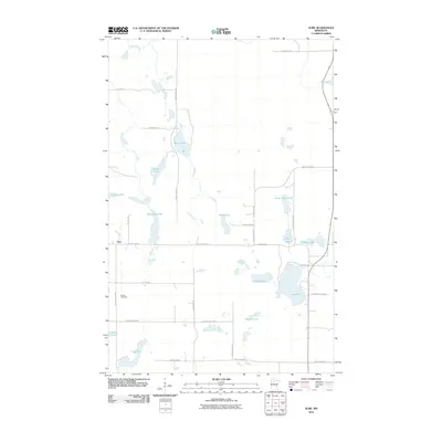
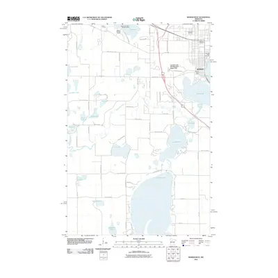
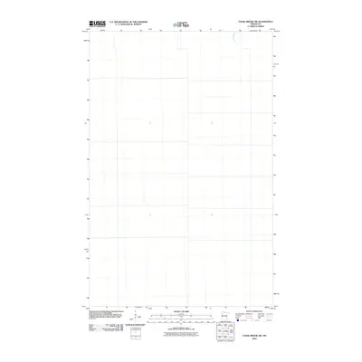
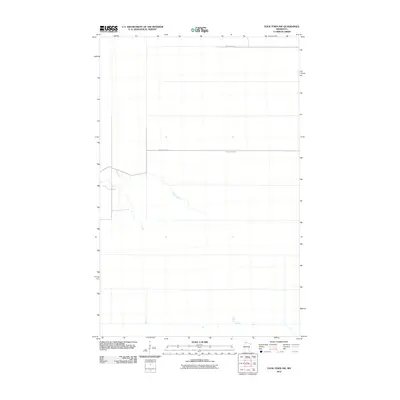
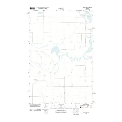
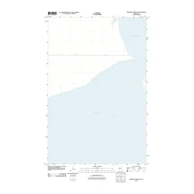
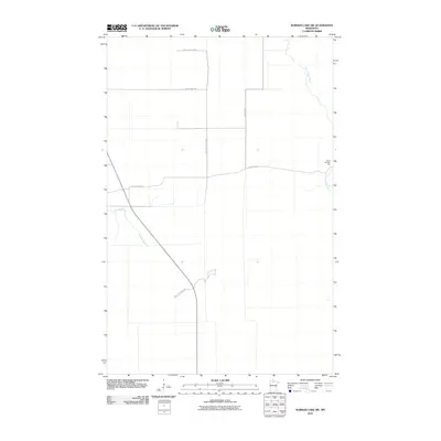
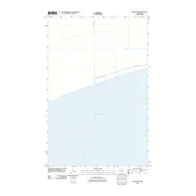
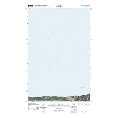
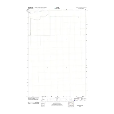
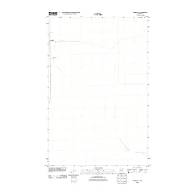
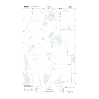
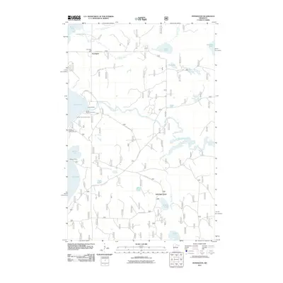
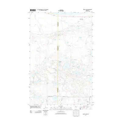
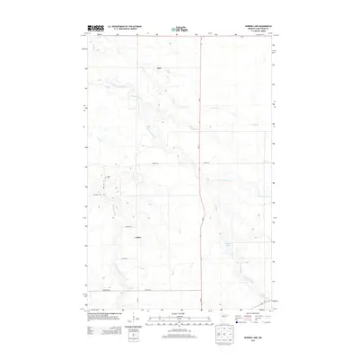
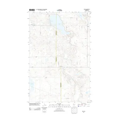
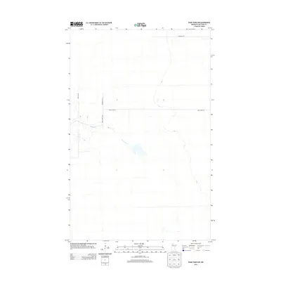
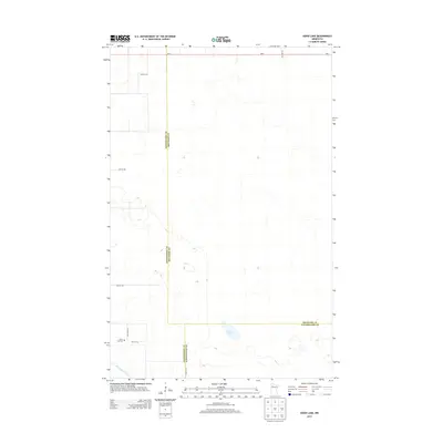
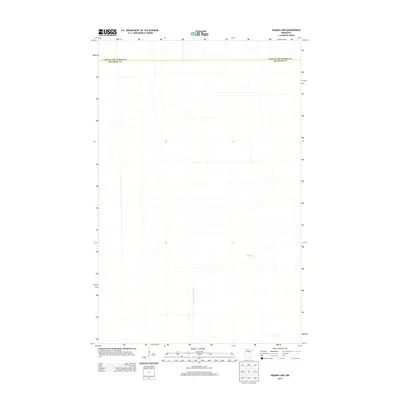
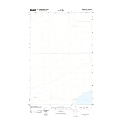
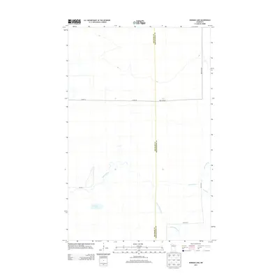
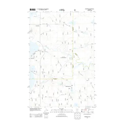
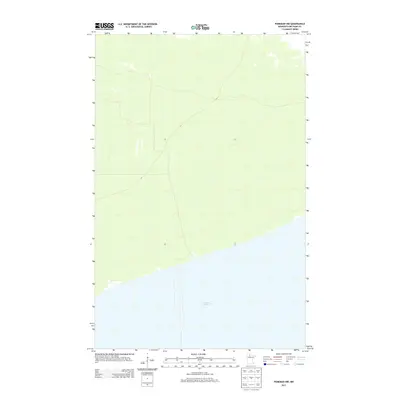
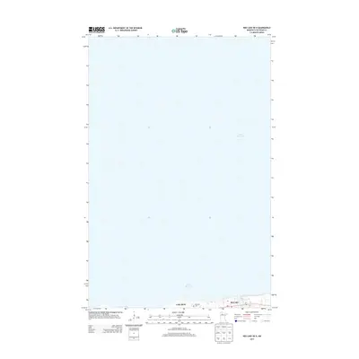
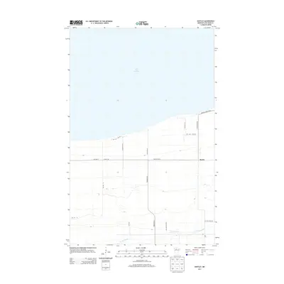
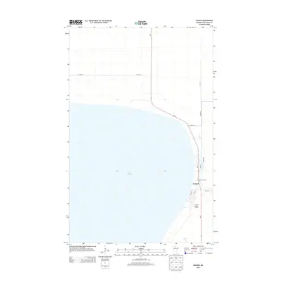
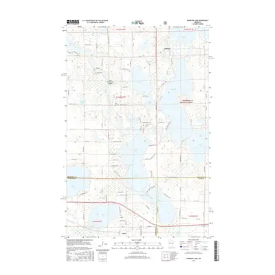
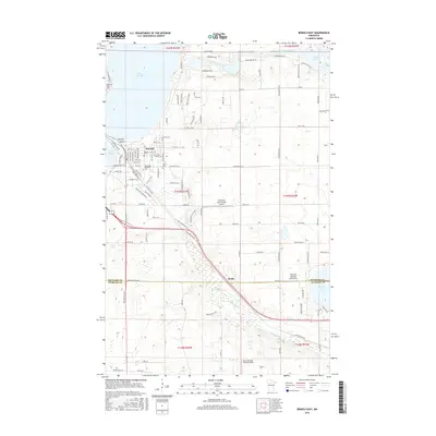
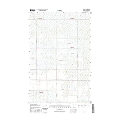
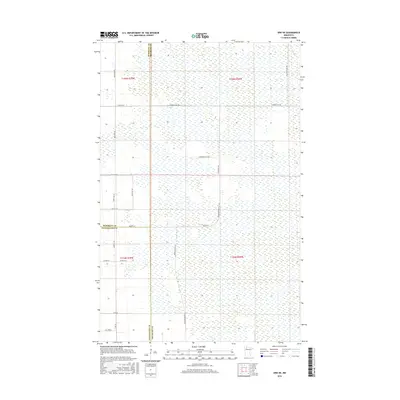
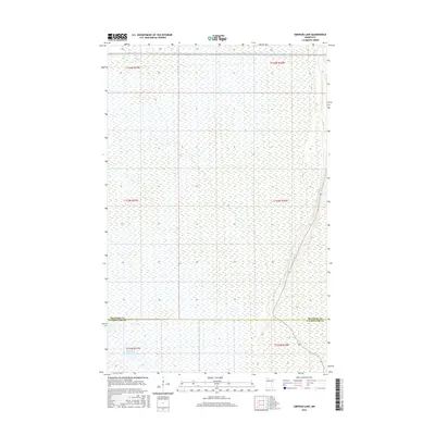
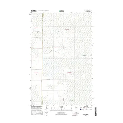
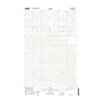
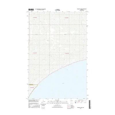
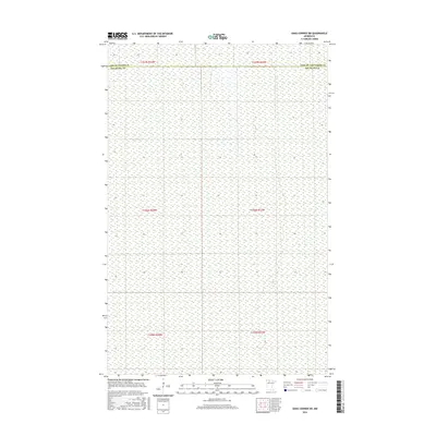
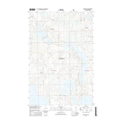
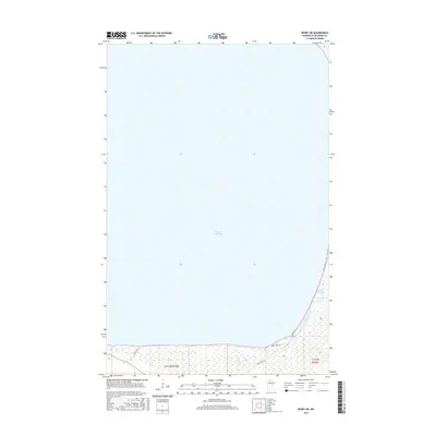
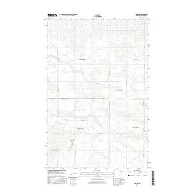
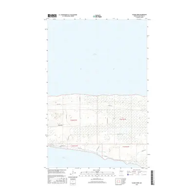
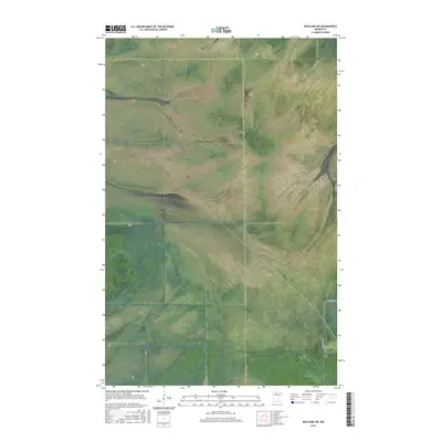
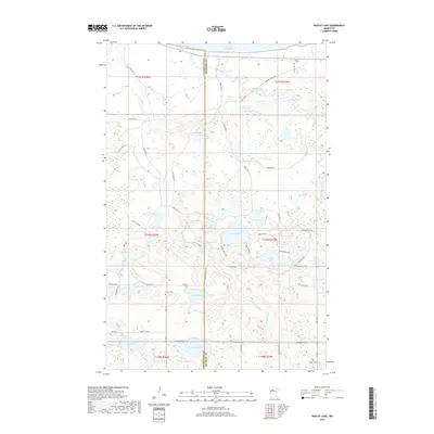
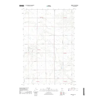
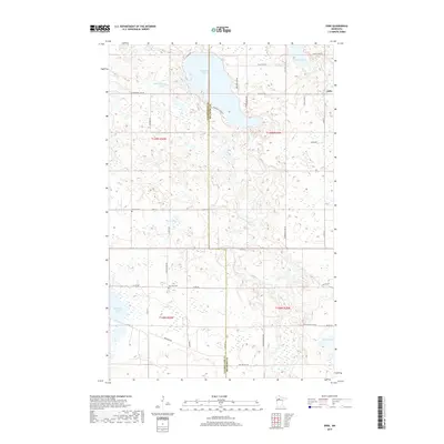
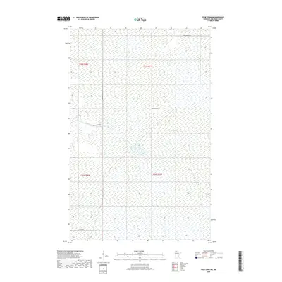
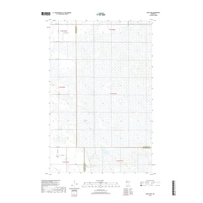
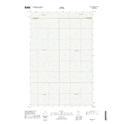
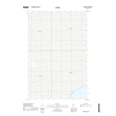
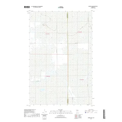
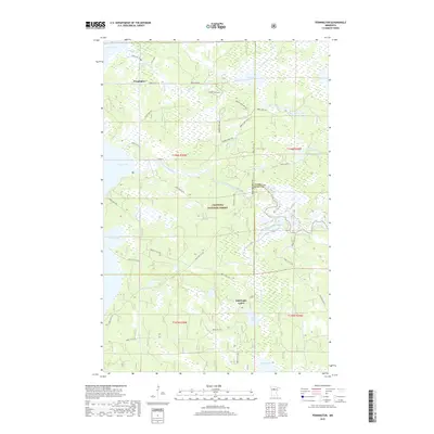
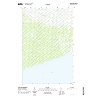
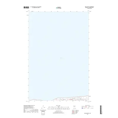
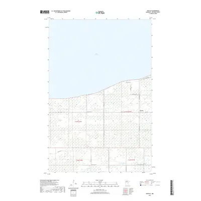
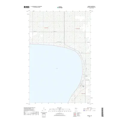
1973 Map of Ludlow Lookout Tower
USGS Topo · Published 1976About this map
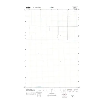
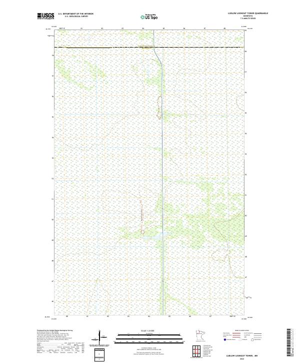
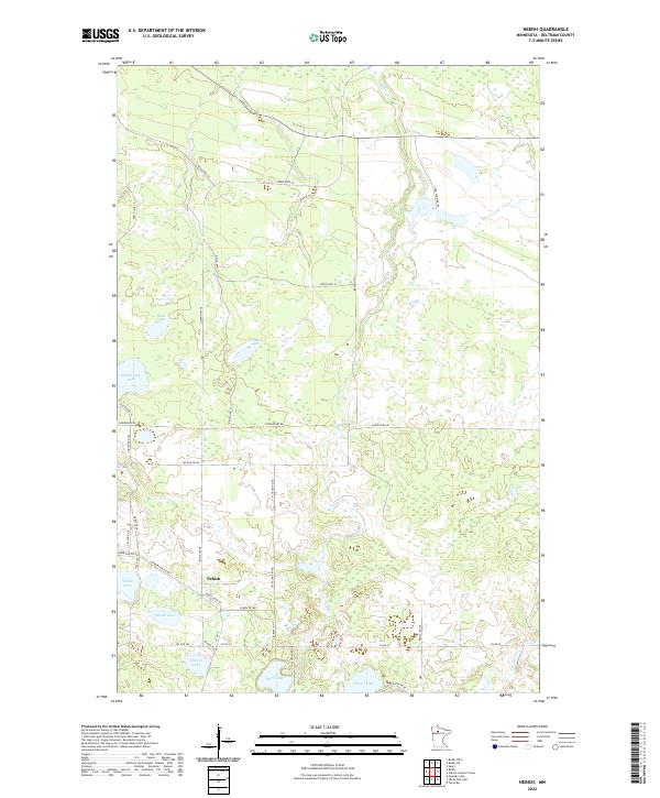
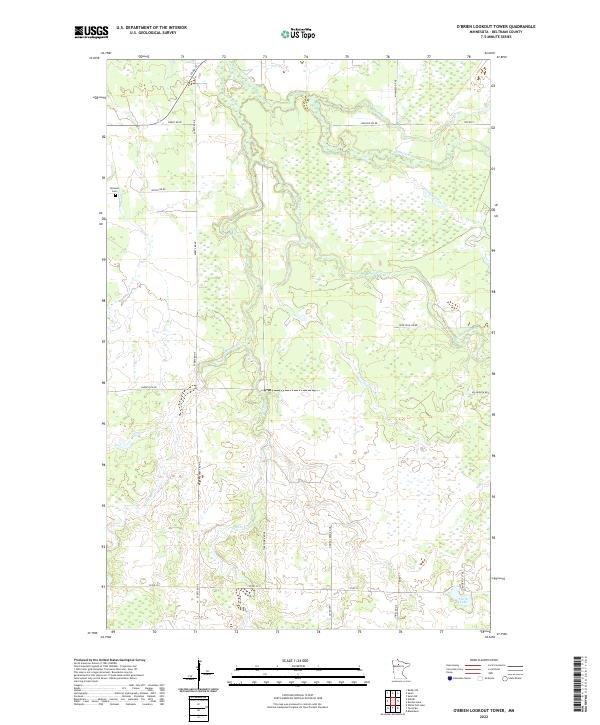
Red Lake State Wildlife Management Area dominates this northern Minnesota landscape, a vast expanse of wetlands and timber as documented in the early 1970s. The terrain is marked by the distinct diagonal scarring of a Winter Trail, reflecting the seasonal movement required in this water-rich environment. Centrally located within this wilderness is the Ludlow Lookout Tower, a critical landmark for forestry and fire observation during this era. The boundary between Lake of the Woods County and Beltrami County cuts through the northern portion of the map, illustrating the remote borderlands of these two regions. A small Gravel Pit near the tower provides evidence of localized resource extraction used for maintaining the area's limited road network.
Find a feature on this map
5 named features on this map. Tap any name to fly to it.
Don’t see what you’re looking for? This feature index may not catch every label — zoom into the map to look around manually.
Map Details
Editions of this 1973 Ludlow Lookout Tower Map
This is the sole edition of this map. No revisions or reprints were ever made.
Historical Maps of Beltrami County Through Time
340 maps found

1918 F
Beltrami County, MN

1918 Jelle
Beltrami County, MN

1918 Malcolm
Beltrami County, MN

1919 Fox
Beltrami County, MN

1919 Quiring
Beltrami County, MN

1919 Rosy
Beltrami County, MN

1920 Buena Vista
Beltrami County, MN

1968 Bemidji East
Beltrami County, MN

1968 Bemidji West
Beltrami County, MN

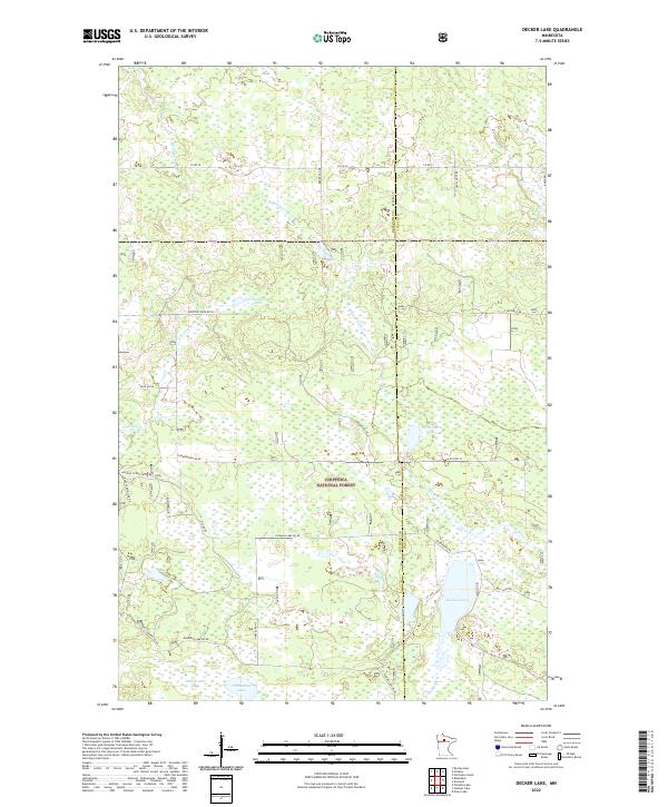
1971 Decker Lake
Beltrami County, MN

1971 Gimmer Lake
Beltrami County, MN

1971 Pennington
Beltrami County, MN

1972 Andrusia Lake
Beltrami County, MN

1972 Aure
Beltrami County, MN

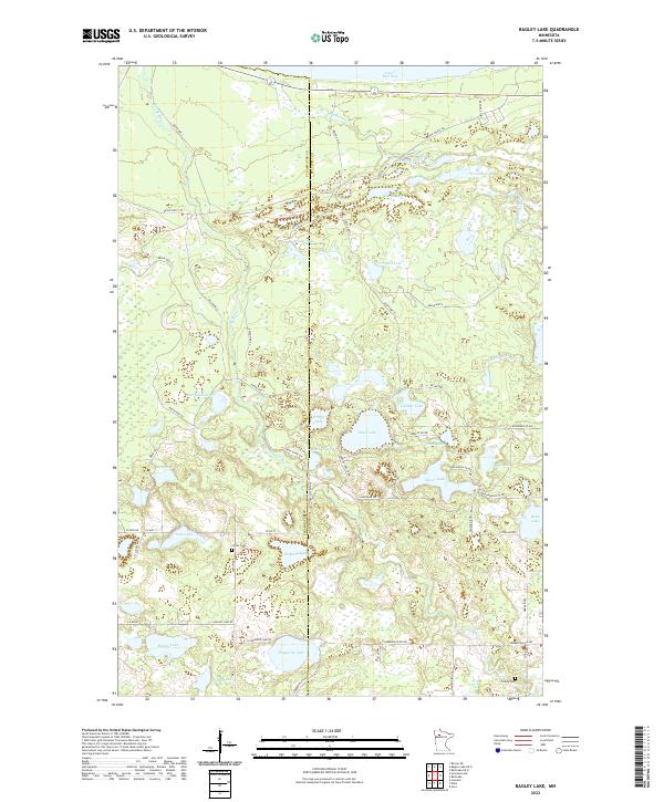
1972 Bagley Lake
Beltrami County, MN

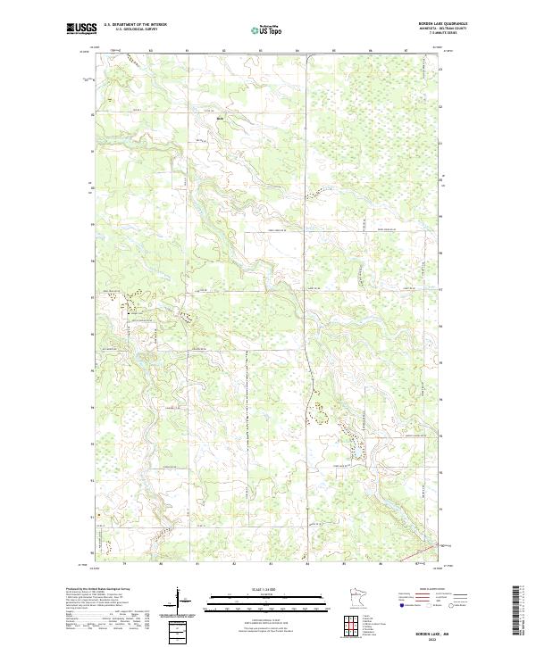
1972 Borden Lake
Beltrami County, MN

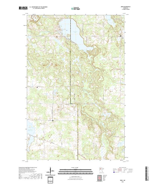
1972 Debs
Beltrami County, MN

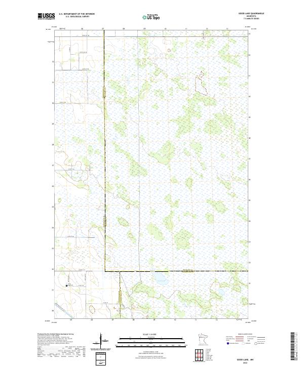
1972 Good Lake
Beltrami County, MN

1972 Grant Lake
Beltrami County, MN

1972 Nebish
Beltrami County, MN

1972 O'Brien Lookout Tower
Beltrami County, MN

1972 Peterson Lake
Beltrami County, MN

1972 Pimushe Lake
Beltrami County, MN

1972 Puposky Lake
Beltrami County, MN

1972 Redby NE
Beltrami County, MN

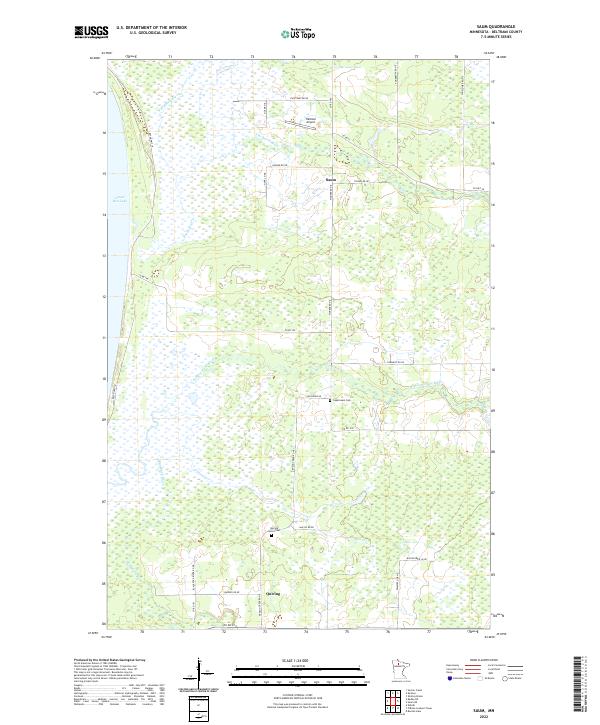
1972 Saum
Beltrami County, MN

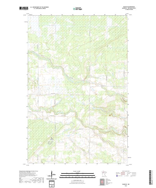
1972 Saum NE
Beltrami County, MN

1972 Turtle River Lake
Beltrami County, MN

1972 White Fish Lake
Beltrami County, MN

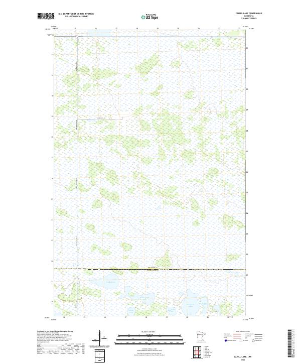
1973 Cahill Lake
Beltrami County, MN

1973 Carmel
Beltrami County, MN

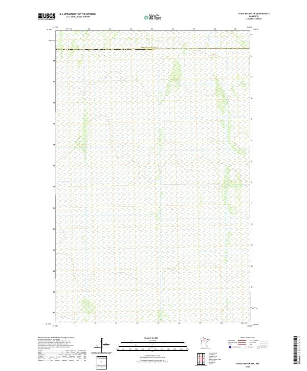
1973 Chase Brook SW
Beltrami County, MN

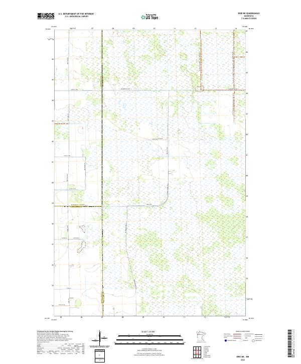
1973 Erie NE
Beltrami County, MN

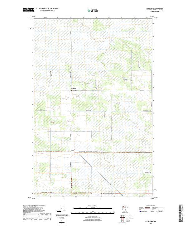
1973 Four Town
Beltrami County, MN

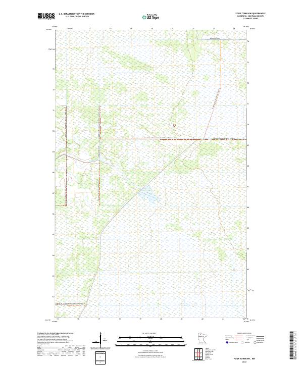
1973 Four Town NW
Beltrami County, MN

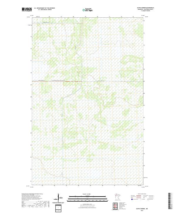
1973 Gates Corner
Beltrami County, MN

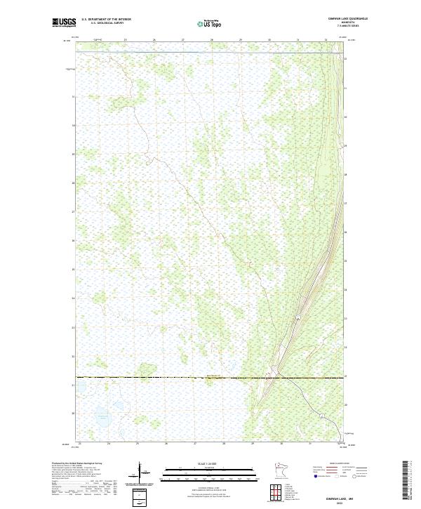
1973 Gimiwan Lake
Beltrami County, MN

1973 Grygla NE
Beltrami County, MN

1973 Head of Rapid River
Beltrami County, MN

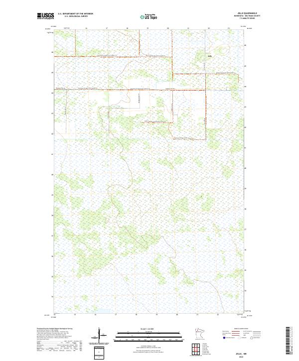
1973 Jelle
Beltrami County, MN

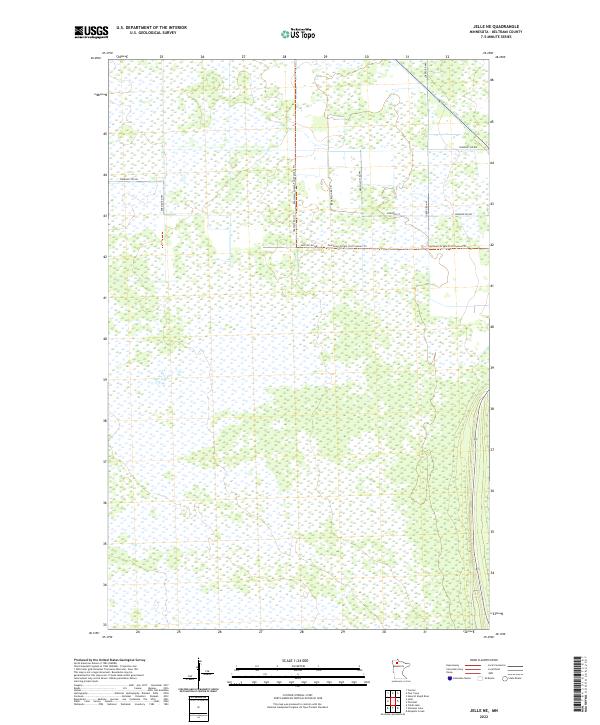
1973 Jelle NE
Beltrami County, MN
1973 Ludlow Lookout Tower
Beltrami County, MN

1973 Manomin Creek
Beltrami County, MN

1973 Manomin Creek SE
Beltrami County, MN

1973 Mosquito Creek
Beltrami County, MN

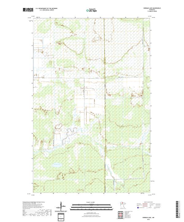
1973 Norman Lake
Beltrami County, MN

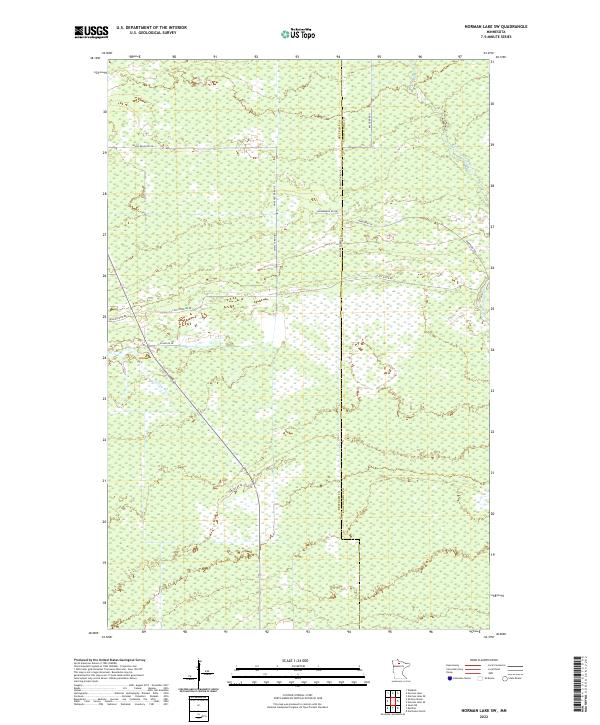
1973 Norman Lake SW
Beltrami County, MN

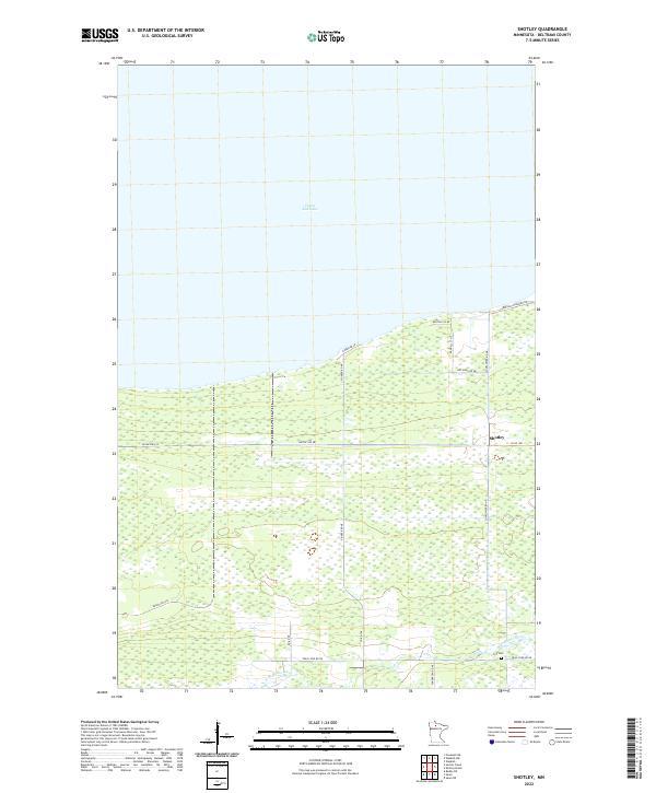
1973 Shotley
Beltrami County, MN

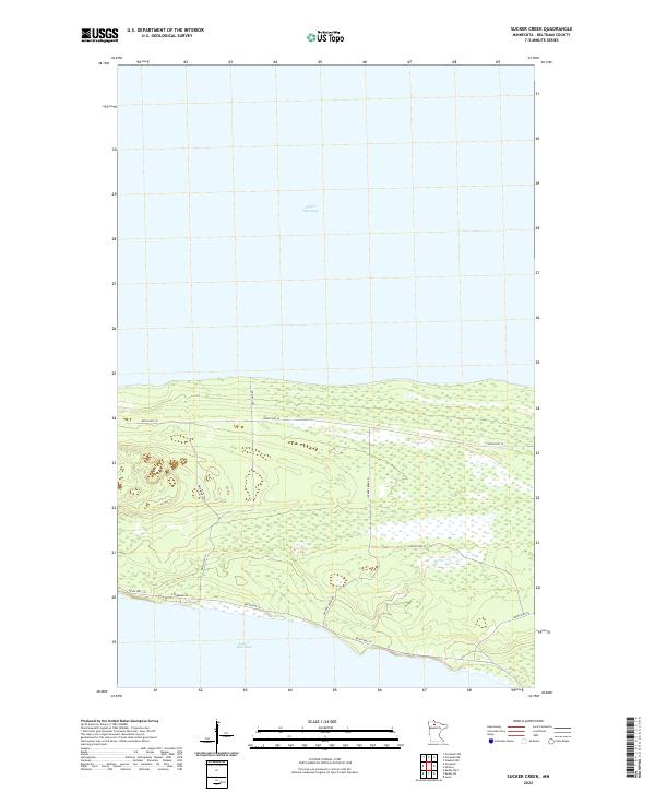
1973 Sucker Creek
Beltrami County, MN

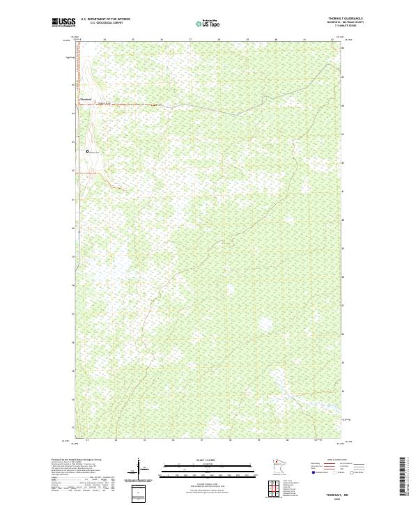
1973 Thorhult
Beltrami County, MN

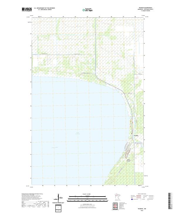
1973 Waskish
Beltrami County, MN

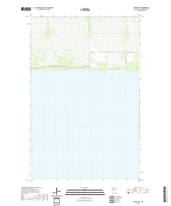
1973 Waskish NW
Beltrami County, MN

1973 Wayland SW
Beltrami County, MN

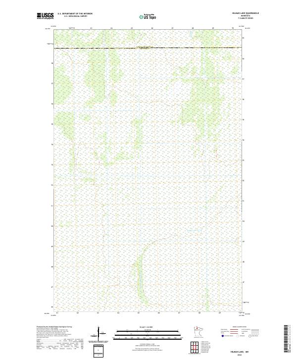
1974 Hilman Lake
Beltrami County, MN

1974 Oaks Corner SW
Beltrami County, MN

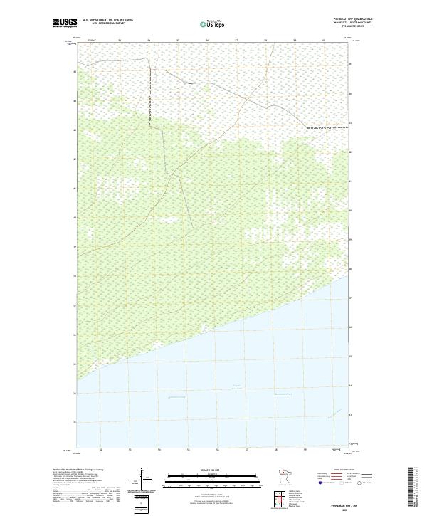
1974 Ponemah NE
Beltrami County, MN

1974 Ponemah NW
Beltrami County, MN

1974 Shilling Dam
Beltrami County, MN

1974 Shotley Brook
Beltrami County, MN

1996 Andrusia Lake
Beltrami County, MN

1996 Decker Lake
Beltrami County, MN

1996 Gimmer Lake
Beltrami County, MN

1996 Pennington
Beltrami County, MN

1996 Pimushe Lake
Beltrami County, MN

1996 Turtle River Lake
Beltrami County, MN
2010 Aure
Beltrami County, MN
2010 Bagley Lake
Beltrami County, MN
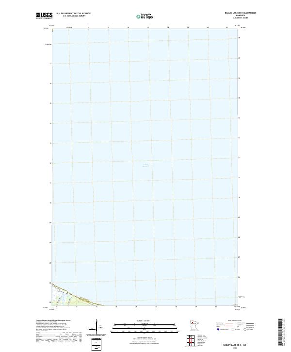
2010 Bagley Lake OE N
Beltrami County, MN
2010 Bemidji East
Beltrami County, MN
2010 Bemidji West
Beltrami County, MN
2010 Borden Lake
Beltrami County, MN
2010 Cahill Lake
Beltrami County, MN
2010 Carmel
Beltrami County, MN
2010 Chase Brook SW
Beltrami County, MN
2010 Debs
Beltrami County, MN
2010 Erie NE
Beltrami County, MN
2010 Four Town
Beltrami County, MN
2010 Four Town NW
Beltrami County, MN
2010 Gates Corner
Beltrami County, MN
2010 Gimiwan Lake
Beltrami County, MN
2010 Good Lake
Beltrami County, MN
2010 Grant Lake
Beltrami County, MN
2010 Grygla NE
Beltrami County, MN
2010 Head of Rapid River
Beltrami County, MN
2010 Hilman Lake
Beltrami County, MN
2010 Jelle
Beltrami County, MN
2010 Jelle NE
Beltrami County, MN
2010 Ludlow Lookout Tower
Beltrami County, MN
2010 Manomin Creek
Beltrami County, MN
2010 Manomin Creek SE
Beltrami County, MN
2010 Mosquito Creek
Beltrami County, MN
2010 Nebish
Beltrami County, MN
2010 Norman Lake
Beltrami County, MN
2010 Norman Lake SW
Beltrami County, MN
2010 Oaks Corner SW
Beltrami County, MN
2010 O'Brien Lookout Tower
Beltrami County, MN
2010 Peterson Lake
Beltrami County, MN
2010 Ponemah NE
Beltrami County, MN
2010 Ponemah NW
Beltrami County, MN
2010 Puposky Lake
Beltrami County, MN
2010 Redby NE
Beltrami County, MN
2010 Redby OE N
Beltrami County, MN
2010 Red Lake OE N
Beltrami County, MN
2010 Saum
Beltrami County, MN
2010 Saum NE
Beltrami County, MN
2010 Shilling Dam
Beltrami County, MN
2010 Shotley
Beltrami County, MN
2010 Shotley Brook
Beltrami County, MN
2010 Sucker Creek
Beltrami County, MN
2010 Thorhult
Beltrami County, MN
2010 Waskish
Beltrami County, MN
2010 Waskish NW
Beltrami County, MN
2010 Wayland SW
Beltrami County, MN
2010 White Fish Lake
Beltrami County, MN
2011 Andrusia Lake
Beltrami County, MN
2011 Decker Lake
Beltrami County, MN
2011 Gimmer Lake
Beltrami County, MN
2011 Pennington
Beltrami County, MN
2011 Pimushe Lake
Beltrami County, MN

2011 Turtle River Lake
Beltrami County, MN
2013 Andrusia Lake
Beltrami County, MN
2013 Aure
Beltrami County, MN
2013 Bagley Lake
Beltrami County, MN
2013 Bagley Lake OE N
Beltrami County, MN
2013 Bemidji East
Beltrami County, MN
2013 Bemidji West
Beltrami County, MN
2013 Borden Lake
Beltrami County, MN
2013 Cahill Lake
Beltrami County, MN
2013 Carmel
Beltrami County, MN
2013 Chase Brook SW
Beltrami County, MN
2013 Debs
Beltrami County, MN
2013 Decker Lake
Beltrami County, MN
2013 Erie NE
Beltrami County, MN
2013 Four Town
Beltrami County, MN
2013 Four Town NW
Beltrami County, MN
2013 Gates Corner
Beltrami County, MN
2013 Gimiwan Lake
Beltrami County, MN
2013 Gimmer Lake
Beltrami County, MN
2013 Good Lake
Beltrami County, MN
2013 Grant Lake
Beltrami County, MN
2013 Grygla NE
Beltrami County, MN
2013 Head of Rapid River
Beltrami County, MN
2013 Hilman Lake
Beltrami County, MN
2013 Jelle
Beltrami County, MN
2013 Jelle NE
Beltrami County, MN
2013 Ludlow Lookout Tower
Beltrami County, MN
2013 Manomin Creek
Beltrami County, MN
2013 Manomin Creek SE
Beltrami County, MN
2013 Mosquito Creek
Beltrami County, MN
2013 Nebish
Beltrami County, MN
2013 Norman Lake
Beltrami County, MN
2013 Norman Lake SW
Beltrami County, MN
2013 Oaks Corner SW
Beltrami County, MN
2013 O'Brien Lookout Tower
Beltrami County, MN
2013 Pennington
Beltrami County, MN
2013 Peterson Lake
Beltrami County, MN
2013 Pimushe Lake
Beltrami County, MN
2013 Ponemah NE
Beltrami County, MN
2013 Ponemah NW
Beltrami County, MN
2013 Puposky Lake
Beltrami County, MN
2013 Redby NE
Beltrami County, MN
2013 Redby OE N
Beltrami County, MN
2013 Red Lake OE N
Beltrami County, MN
2013 Saum
Beltrami County, MN
2013 Saum NE
Beltrami County, MN
2013 Shilling Dam
Beltrami County, MN
2013 Shotley
Beltrami County, MN
2013 Shotley Brook
Beltrami County, MN
2013 Sucker Creek
Beltrami County, MN
2013 Thorhult
Beltrami County, MN

2013 Turtle River Lake
Beltrami County, MN
2013 Waskish
Beltrami County, MN
2013 Waskish NW
Beltrami County, MN
2013 Wayland SW
Beltrami County, MN
2013 White Fish Lake
Beltrami County, MN
2016 Andrusia Lake
Beltrami County, MN
2016 Aure
Beltrami County, MN
2016 Bagley Lake
Beltrami County, MN
2016 Bagley Lake OE N
Beltrami County, MN
2016 Bemidji East
Beltrami County, MN
2016 Bemidji West
Beltrami County, MN
2016 Borden Lake
Beltrami County, MN
2016 Cahill Lake
Beltrami County, MN
2016 Carmel
Beltrami County, MN
2016 Chase Brook SW
Beltrami County, MN
2016 Debs
Beltrami County, MN
2016 Decker Lake
Beltrami County, MN
2016 Erie NE
Beltrami County, MN
2016 Four Town
Beltrami County, MN
2016 Four Town NW
Beltrami County, MN
2016 Gates Corner
Beltrami County, MN
2016 Gimiwan Lake
Beltrami County, MN
2016 Gimmer Lake
Beltrami County, MN
2016 Good Lake
Beltrami County, MN
2016 Grant Lake
Beltrami County, MN
2016 Grygla NE
Beltrami County, MN
2016 Head of Rapid River
Beltrami County, MN
2016 Hilman Lake
Beltrami County, MN
2016 Jelle
Beltrami County, MN
2016 Jelle NE
Beltrami County, MN
2016 Ludlow Lookout Tower
Beltrami County, MN
2016 Manomin Creek
Beltrami County, MN
2016 Manomin Creek SE
Beltrami County, MN
2016 Mosquito Creek
Beltrami County, MN
2016 Nebish
Beltrami County, MN
2016 Norman Lake
Beltrami County, MN
2016 Norman Lake SW
Beltrami County, MN
2016 Oaks Corner SW
Beltrami County, MN
2016 O'Brien Lookout Tower
Beltrami County, MN
2016 Pennington
Beltrami County, MN
2016 Peterson Lake
Beltrami County, MN
2016 Pimushe Lake
Beltrami County, MN
2016 Ponemah NE
Beltrami County, MN
2016 Ponemah NW
Beltrami County, MN
2016 Puposky Lake
Beltrami County, MN
2016 Redby NE
Beltrami County, MN
2016 Redby OE N
Beltrami County, MN
2016 Red Lake OE N
Beltrami County, MN
2016 Saum
Beltrami County, MN
2016 Saum NE
Beltrami County, MN
2016 Shilling Dam
Beltrami County, MN
2016 Shotley
Beltrami County, MN
2016 Shotley Brook
Beltrami County, MN
2016 Sucker Creek
Beltrami County, MN
2016 Thorhult
Beltrami County, MN

2016 Turtle River Lake
Beltrami County, MN
2016 Waskish
Beltrami County, MN
2016 Waskish NW
Beltrami County, MN
2016 Wayland SW
Beltrami County, MN
2016 White Fish Lake
Beltrami County, MN
2019 Andrusia Lake
Beltrami County, MN
2019 Aure
Beltrami County, MN
2019 Bagley Lake
Beltrami County, MN
2019 Bagley Lake OE N
Beltrami County, MN
2019 Bemidji East
Beltrami County, MN
2019 Bemidji West
Beltrami County, MN
2019 Borden Lake
Beltrami County, MN
2019 Cahill Lake
Beltrami County, MN
2019 Carmel
Beltrami County, MN
2019 Chase Brook SW
Beltrami County, MN
2019 Debs
Beltrami County, MN
2019 Decker Lake
Beltrami County, MN
2019 Erie NE
Beltrami County, MN
2019 Four Town
Beltrami County, MN
2019 Four Town NW
Beltrami County, MN
2019 Gates Corner
Beltrami County, MN
2019 Gimiwan Lake
Beltrami County, MN
2019 Gimmer Lake
Beltrami County, MN
2019 Good Lake
Beltrami County, MN
2019 Grant Lake
Beltrami County, MN
2019 Grygla NE
Beltrami County, MN
2019 Head of Rapid River
Beltrami County, MN
2019 Hilman Lake
Beltrami County, MN
2019 Jelle
Beltrami County, MN
2019 Jelle NE
Beltrami County, MN
2019 Ludlow Lookout Tower
Beltrami County, MN
2019 Manomin Creek
Beltrami County, MN
2019 Manomin Creek SE
Beltrami County, MN
2019 Mosquito Creek
Beltrami County, MN
2019 Nebish
Beltrami County, MN
2019 Norman Lake
Beltrami County, MN
2019 Norman Lake SW
Beltrami County, MN
2019 Oaks Corner SW
Beltrami County, MN
2019 O'Brien Lookout Tower
Beltrami County, MN
2019 Pennington
Beltrami County, MN
2019 Peterson Lake
Beltrami County, MN
2019 Pimushe Lake
Beltrami County, MN
2019 Ponemah NE
Beltrami County, MN
2019 Ponemah NW
Beltrami County, MN
2019 Puposky Lake
Beltrami County, MN
2019 Redby NE
Beltrami County, MN
2019 Redby OE N
Beltrami County, MN
2019 Red Lake OE N
Beltrami County, MN
2019 Saum
Beltrami County, MN
2019 Saum NE
Beltrami County, MN
2019 Shilling Dam
Beltrami County, MN
2019 Shotley
Beltrami County, MN
2019 Shotley Brook
Beltrami County, MN
2019 Sucker Creek
Beltrami County, MN
2019 Thorhult
Beltrami County, MN

2019 Turtle River Lake
Beltrami County, MN
2019 Waskish
Beltrami County, MN
2019 Waskish NW
Beltrami County, MN
2019 Wayland SW
Beltrami County, MN
2019 White Fish Lake
Beltrami County, MN

2022 Andrusia Lake
Beltrami County, MN

2022 Aure
Beltrami County, MN
2022 Bagley Lake
Beltrami County, MN
2022 Bagley Lake OE N
Beltrami County, MN

2022 Bemidji East
Beltrami County, MN

2022 Bemidji West
Beltrami County, MN
2022 Borden Lake
Beltrami County, MN
2022 Cahill Lake
Beltrami County, MN

2022 Carmel
Beltrami County, MN
2022 Chase Brook SW
Beltrami County, MN
2022 Debs
Beltrami County, MN
2022 Decker Lake
Beltrami County, MN
2022 Erie NE
Beltrami County, MN
2022 Four Town
Beltrami County, MN
2022 Four Town NW
Beltrami County, MN
2022 Gates Corner
Beltrami County, MN
2022 Gimiwan Lake
Beltrami County, MN

2022 Gimmer Lake
Beltrami County, MN
2022 Good Lake
Beltrami County, MN

2022 Grant Lake
Beltrami County, MN

2022 Grygla NE
Beltrami County, MN

2022 Head of Rapid River
Beltrami County, MN
2022 Hilman Lake
Beltrami County, MN
2022 Jelle
Beltrami County, MN
2022 Jelle NE
Beltrami County, MN
2022 Ludlow Lookout Tower
Beltrami County, MN
2022 Manomin Creek
Beltrami County, MN
2022 Manomin Creek SE
Beltrami County, MN
2022 Mosquito Creek
Beltrami County, MN
2022 Nebish
Beltrami County, MN
2022 Norman Lake
Beltrami County, MN
2022 Norman Lake SW
Beltrami County, MN
2022 Oaks Corner SW
Beltrami County, MN
2022 O'Brien Lookout Tower
Beltrami County, MN
2022 Pennington
Beltrami County, MN

2022 Peterson Lake
Beltrami County, MN
2022 Pimushe Lake
Beltrami County, MN
2022 Ponemah NE
Beltrami County, MN
2022 Ponemah NW
Beltrami County, MN
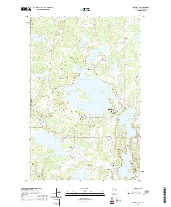
2022 Puposky Lake
Beltrami County, MN

2022 Redby NE
Beltrami County, MN
2022 Redby OE N
Beltrami County, MN
2022 Red Lake OE N
Beltrami County, MN
2022 Saum
Beltrami County, MN
2022 Saum NE
Beltrami County, MN

2022 Shilling Dam
Beltrami County, MN
2022 Shotley
Beltrami County, MN

2022 Shotley Brook
Beltrami County, MN
2022 Sucker Creek
Beltrami County, MN
2022 Thorhult
Beltrami County, MN

2022 Turtle River Lake
Beltrami County, MN
2022 Waskish
Beltrami County, MN
2022 Waskish NW
Beltrami County, MN

2022 Wayland SW
Beltrami County, MN

2022 White Fish Lake
Beltrami County, MN