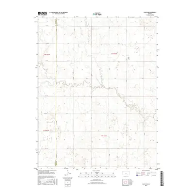
2015 Map of Chase NW
USGS Topo · Published 2015About this map
Cow Creek winds through this central Kansas landscape along the border of Barton and Rice counties. The area is defined by its rigorous section-line grid, where roads like NE 90 Road and 1st Road trace the boundaries of historic farmsteads. Local history and genealogy are anchored by small rural burial grounds, specifically Montgomery Cemetery in the northwest and Salem - Fried of Cemetery in the eastern portion of the quadrangle. These sites, along with watercourses such as Calf Creek and Little Cheyenne Creek, provide the primary landmarks in an otherwise open agricultural expanse. The map illustrates the persistent 19th-century township and range system, showing the organized division of land into sections like t18s r11w and t19s r10w that shaped the settlement of the Plains.
Find a feature on this map
35 named features on this map. Tap any name to fly to it.
Don’t see what you’re looking for? This feature index may not catch every label — zoom into the map to look around manually.
Map Details
Editions of this 2015 Chase NW Map
This is the sole edition of this map. No revisions or reprints were ever made.
Other maps of this area

1891 · Great Bend
USGS Topo · 1:125,000

1893 · Great Bend
USGS Topo · 1:125,000

1894 · Ellsworth
USGS Topo · 1:125,000

1894 · Lyons
USGS Topo · 1:125,000

1896 · Russell
USGS Topo · 1:125,000

1955 · Great Bend
USGS Topo · 1:250,000

1956 · Ellinwood NE
USGS Topo · 1:24,000

1957 · Great Bend
USGS Topo · 1:250,000

1957 · Ellinwood
USGS Topo · 1:24,000

1958 · Great Bend
USGS Topo · 1:250,000