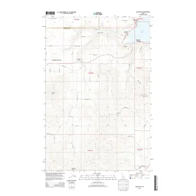
2013 Map of Chatcolet
USGS Topo · Published 2013About this map
Heyburn State Park dominates the northeastern corner of this Idaho landscape, where the waters of Chatcolet Lake meet the shoreline at Hawleys Landing. This area, situated along the border of Kootenai and Benewah Counties, showcases a diverse terrain ranging from the high elevations of Plummer Butte to the drainages of Plummer Cr and Little Plummer Cr. The settlement pattern reflects a history of small communities and rural intersections, including Plummer Junction and the small siding at Pedee. In the southern reaches, the Minaloosa Valley provides a distinct contrast to the more timbered slopes found near Sq'wdusmn Bench and Whitetail Draw. These features represent a landscape defined by its connection to the southern end of the Coeur d'Alene Lake system and the various creeks like Benewah Cr that feed into it.
Find a feature on this map
52 named features on this map. Tap any name to fly to it.
Don’t see what you’re looking for? This feature index may not catch every label — zoom into the map to look around manually.
Map Details
Editions of this 2013 Chatcolet Map
This is the sole edition of this map. No revisions or reprints were ever made.
Other maps of this area

1955 · Spokane
USGS Topo · 1:250,000

1957 · St. Maries
USGS Topo · 1:62,500

1957 · Emida
USGS Topo · 1:62,500

1957 · Plummer
USGS Topo · 1:62,500

1957 · Tensed
USGS Topo · 1:62,500

1958 · Spokane
USGS Topo · 1:250,000

1975 · Plummer NW
USGS Topo · 1:24,000

1975 · Plummer SE
USGS Topo · 1:24,000

1975 · Plummer NE
USGS Topo · 1:24,000

1981 · St Maries
USGS Topo · 1:100,000