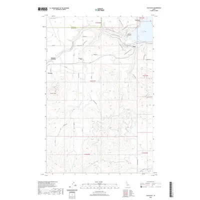
2020 Map of Chatcolet
USGS Topo · Published 2020About this map
Plummer and Chatcolet serve as primary landmarks in this part of northern Idaho, where the landscape transitions from the shores of Chatcolet Lake to the higher elevations of Plummer Butte. The drainage of Plummer Creek and its various forks, including Little Plummer Cr, carve through the terrain, defining the geography of the Minaloosa Valley. This modern survey illustrates a landscape heavily utilized for recreation and transit, featuring a dense network of trails such as the Trail Of The Coeur D' Alene's, the Ccc Nature Trail, and the Whitetail Loop Bike Trail. These paths weave through the Plummer Peninsula and around the small settlement of Pedee, reflecting the shift from early rail-and-river settlement to contemporary conservation and outdoor access. Local history is traced through family-named roads like Bill Morris Rd and Grays Ln, alongside established junctions like Plummer Junction.
Find a feature on this map
52 named features on this map. Tap any name to fly to it.
Don’t see what you’re looking for? This feature index may not catch every label — zoom into the map to look around manually.
Map Details
Editions of this 2020 Chatcolet Map
This is the sole edition of this map. No revisions or reprints were ever made.
Other maps of this area

1955 · Spokane
USGS Topo · 1:250,000

1957 · St. Maries
USGS Topo · 1:62,500

1957 · Emida
USGS Topo · 1:62,500

1957 · Plummer
USGS Topo · 1:62,500

1957 · Tensed
USGS Topo · 1:62,500

1958 · Spokane
USGS Topo · 1:250,000

1975 · Plummer NW
USGS Topo · 1:24,000

1975 · Plummer SE
USGS Topo · 1:24,000

1975 · Plummer NE
USGS Topo · 1:24,000

1981 · St Maries
USGS Topo · 1:100,000