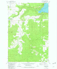
1981 Map of Chatcolet
USGS Topo · Published 1982About this map
Heyburn State Park encompasses a significant portion of this North Idaho landscape, centered around the recreational and transport corridor of Chatcolet Lake. The geography is defined by the Minaloosa Valley and the elevations of Plummer Butte, where the topography transitions from wooded uplands to the marshy edges of the lake. Transport networks are vital here, with the Union Pacific and St Maries River railroads skirting the northern shorelines and passing through the settlement of Chatcolet.
Find a feature on this map
27 named features on this map. Tap any name to fly to it.
Don’t see what you’re looking for? This feature index may not catch every label — zoom into the map to look around manually.
Map Details
Editions of this 1981 Chatcolet Map
This is the sole edition of this map. No revisions or reprints were ever made.
Other maps of this area

1955 · Spokane
USGS Topo · 1:250,000

1957 · St. Maries
USGS Topo · 1:62,500

1957 · Emida
USGS Topo · 1:62,500

1957 · Plummer
USGS Topo · 1:62,500

1957 · Tensed
USGS Topo · 1:62,500

1958 · Spokane
USGS Topo · 1:250,000

1975 · Plummer NW
USGS Topo · 1:24,000

1975 · Plummer SE
USGS Topo · 1:24,000

1975 · Plummer NE
USGS Topo · 1:24,000

1981 · St Maries
USGS Topo · 1:100,000