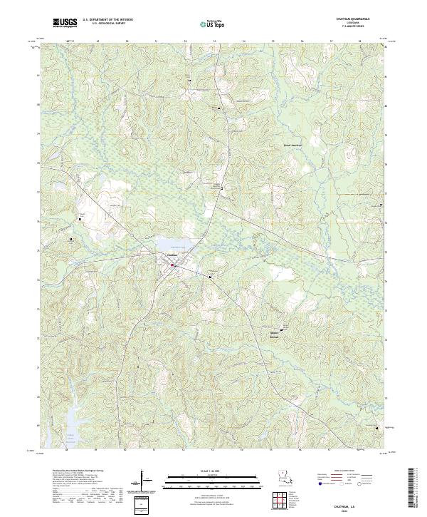
2024 Map of Chatham
USGS Topo · Published 2024About this map
Chatham serves as the central hub of this northern Louisiana landscape, situated where Edwards Branch meets the shores of Chatham Lake. The town's grid is clearly defined by local thoroughfares such as Chatham Ave and Mill St, radiating out toward smaller rural clusters like Mount Moriah and Wood Junction. The area is notably dense with family and community burial grounds, including Old Bethel Cem and Greater Apostolic Church Cem, providing a significant record for genealogical research in Jackson Parish.
Find a feature on this map
96 named features on this map. Tap any name to fly to it.
Don’t see what you’re looking for? This feature index may not catch every label — zoom into the map to look around manually.
Map Details
Editions of this 2024 Chatham Map
This is the sole edition of this map. No revisions or reprints were ever made.
Other maps of this area

1949 · Jonesboro
USGS Topo · 1:62,500

1950 · Jonesboro
USGS Topo · 1:62,500

1953 · Chatham
USGS Topo · 1:62,500

1953 · Hodge
USGS Topo · 1:62,500

1954 · Sikes
USGS Topo · 1:62,500

1955 · Shreveport
USGS Topo · 1:250,000

1956 · Shreveport
USGS Topo · 1:250,000

1982 · Chatham
USGS Topo · 1:24,000

1982 · Chatham SE
USGS Topo · 1:24,000
1982 · Cadeville
USGS Topo · 1:24,000