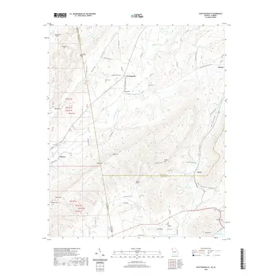
2020 Map of Chattoogaville
USGS Topo · Published 2020About this map
Chattoogaville and the winding Chattooga River define this borderland landscape where Georgia and Alabama meet. The geography is characterized by distinct ridges and valleys, including Dirtseller Mtn and Back Valley Ridge, which separate the various agricultural and residential settlements. Along the river, Prices Bridge provides a key crossing point near the junction of several rural routes like the Holland Chattoogaville Rd. The map reveals a high density of small family and community burial grounds, such as Johnson Cem, Holland Cem, and Carr Cem, which are invaluable for genealogical research in this rural corridor. In the southern portion of the sheet, the terrain transitions toward The Narrows and the Coosa River, while small communities like Fullerton and Sprite sit at the base of elevations like Bogan Mtn and Kincaid Mtn.
Find a feature on this map
84 named features on this map. Tap any name to fly to it.
Don’t see what you’re looking for? This feature index may not catch every label — zoom into the map to look around manually.
Map Details
Editions of this 2020 Chattoogaville Map
This is the sole edition of this map. No revisions or reprints were ever made.
Other maps of this area

1886 · Rome
USGS Topo · 1:125,000

1893 · Fort Payne
USGS Topo · 1:125,000

1898 · Rome
USGS Topo · 1:125,000

1898 · Fort Payne
USGS Topo · 1:125,000

1899 · Rome
USGS Topo · 1:125,000

1900 · Fort Payne
USGS Topo · 1:125,000

1904 · Rome
USGS Topo · 1:125,000

1955 · Rome
USGS Topo · 1:250,000

1958 · Rome
USGS Topo · 1:250,000

1961 · Rome
USGS Topo · 1:250,000