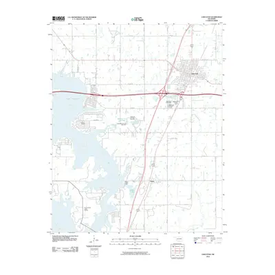
2010 Map of Checotah
USGS Topo · Published 2010About this map
Checotah serves as the primary hub of this eastern Oklahoma landscape, where the convergence of major transit corridors meets the expansive waters of Lake Eufaula. The 2010 geography is defined by the massive impoundment of the Deep Fork and North Canadian River, which dominates the western half of the quadrangle. This area reveals a complex shoreline integrated with recreation and infrastructure, including the Fountainhead Lodge Airpark and numerous municipal water projects like Checotah City Lake West and Checotah City Lake East. Settlement patterns outside the main town are sparse, with the small community of Onapa located to the south near the Onapa Lake Dam. Local history and genealogy are anchored by the Richard Cemetery near the lake's edge and Green Lawn Cemetery south of the city. The map also traces the natural drainage of the territory through several named tributaries, including Elk Creek, Nellie Creek, and Carr Creek, which flow toward the reservoir.
Find a feature on this map
30 named features on this map. Tap any name to fly to it.
Don’t see what you’re looking for? This feature index may not catch every label — zoom into the map to look around manually.
Map Details
Editions of this 2010 Checotah Map
This is the sole edition of this map. No revisions or reprints were ever made.
Other maps of this area

1896 · Okmulgee
USGS Topo · 1:125,000

1900 · Sansbois
USGS Topo · 1:125,000

1900 · Canadian
USGS Topo · 1:125,000

1900 · Okmulgee
USGS Topo · 1:125,000

1901 · Muscogee
USGS Topo · 1:125,000

1905 · Muscogee
USGS Topo · 1:125,000

1909 · Sans Bois
USGS Topo · 1:125,000

1911 · Sansbois
USGS Topo · 1:125,000

1946 · Fort Smith
USGS Topo · 1:250,000

1948 · Keefeton
USGS Topo · 1:62,500