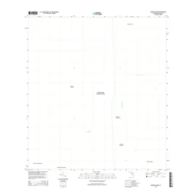
2015 Map of Chekika Island
USGS Topo · Published 2015About this map
Everglades National Park dominates this landscape, preserving a delicate subtropical wilderness defined by slow-moving water and elevated tree islands. The hydrology is centered on the Shark River Slough, a broad drainage way that supports the region's unique ecology. Dotted throughout this marshy expanse are numerous "hammocks"—small, raised stands of hardwood trees named after local natural features and historical figures. These include Vulture Hammock, Poinciana Hammock, and the eponymous Chekika Island. Man-made water management is represented by the Blue Shanty Canal, which cuts through the northeastern portion of the quadrangle. At the southern edge, the terrain rises slightly toward Grossman Ridge, marking a subtle shift in the low-lying topography of Miami-Dade County.
Find a feature on this map
10 named features on this map. Tap any name to fly to it.
Don’t see what you’re looking for? This feature index may not catch every label — zoom into the map to look around manually.
Map Details
Editions of this 2015 Chekika Island Map
This is the sole edition of this map. No revisions or reprints were ever made.
Other maps of this area

1956 · Grossman Hammock
USGS Topo · 1:24,000

1956 · Miami
USGS Topo · 1:250,000

1958 · Miami
USGS Topo · 1:250,000

1972 · Shark Valley Lookout Tower
USGS Topo · 1:24,000

1972 · Chekika Island
USGS Topo · 1:24,000

1972 · Panther Mound
USGS Topo · 1:24,000

1972 · South Of Coopertown
USGS Topo · 1:24,000
1972 · Black Hammock
USGS Topo · 1:24,000

1973 · Fortymile Bend
USGS Topo · 1:24,000

1973 · Long Island
USGS Topo · 1:24,000