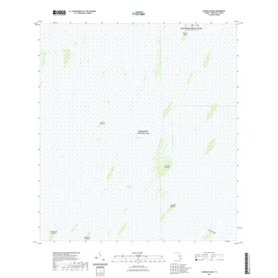
2021 Map of Chekika Island
USGS Topo · Published 2021About this map
Everglades National Park dominates this landscape in Miami-Dade County, preserving a vast expanse of the iconic Florida wetlands. The terrain is characterized by the slow southward movement of water through the Shark River Slough, a critical hydrographic feature of The Everglades. Scattered across this watery expanse are numerous tree islands, or hammocks, which provided vital high ground for human activity and biodiversity. Notable landmarks include Chekika Island in the north and a series of hammocks with evocative names like Vulture Hammock, Poinciana Hammock, and Gumbo Limbo Hammock. The presence of the Blue Shanty Canal and Grossman Ridge reflects the complex history of water management and natural topography in this unique subtropical environment.
Find a feature on this map
11 named features on this map. Tap any name to fly to it.
Don’t see what you’re looking for? This feature index may not catch every label — zoom into the map to look around manually.
Map Details
Editions of this 2021 Chekika Island Map
This is the sole edition of this map. No revisions or reprints were ever made.
Other maps of this area

1956 · Grossman Hammock
USGS Topo · 1:24,000

1956 · Miami
USGS Topo · 1:250,000

1958 · Miami
USGS Topo · 1:250,000

1972 · Shark Valley Lookout Tower
USGS Topo · 1:24,000

1972 · Chekika Island
USGS Topo · 1:24,000

1972 · Panther Mound
USGS Topo · 1:24,000

1972 · South Of Coopertown
USGS Topo · 1:24,000
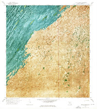
1972 · Black Hammock
USGS Topo · 1:24,000

1973 · Fortymile Bend
USGS Topo · 1:24,000

1973 · Long Island
USGS Topo · 1:24,000