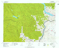
1975 Map of Chelan
USGS Topo · Published 1977About this map
The Entiat Mountains and Chelan Mountains dominate this 1970s landscape, providing a detailed record of the geography between the northern Cascades and the Columbia River. The map illustrates the transition from the high peaks of the Glacier Peak Wilderness to the agricultural expanses of the Waterville Plateau. Significant infrastructure is visible along the river valleys, including the Burlington Northern railroad route through Tumwater Canyon and the Leavenworth National Fish Hatchery.
Find a feature on this map
43 named features on this map. Tap any name to fly to it.
Don’t see what you’re looking for? This feature index may not catch every label — zoom into the map to look around manually.
Map Details
Editions of this 1975 Chelan Map
2 editions found
Other maps of this area

1897 · Mount Stuart
USGS Topo · 1:125,000

1899 · Glacier Peak
USGS Topo · 1:125,000

1899 · Methow
USGS Topo · 1:125,000

1901 · Glacier Peak
USGS Topo · 1:125,000

1901 · Chelan
USGS Topo · 1:125,000

1901 · Methow
USGS Topo · 1:125,000

1901 · Chiwaukum
USGS Topo · 1:125,000

1901 · Snoqualmie Pass
USGS Topo · 1:125,000

1902 · Skykomish
USGS Topo · 1:125,000

1902 · Mount Stuart
USGS Topo · 1:125,000