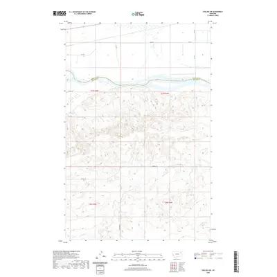
2020 Map of Chelsea SW
USGS Topo · Published 2020About this map
The Missouri River forms a significant geographical and political boundary here, dividing Roosevelt Co and McCone Co in this section of northeastern Montana. The landscape transitions from the relatively flat river valley in the north to the intricately eroded coulees and breaks to the south. This rugged southern terrain is drained by several seasonal waterways, most notably Nickwall Cr, which meanders through the central and southern portions of the quadrangle.
Find a feature on this map
16 named features on this map. Tap any name to fly to it.
Don’t see what you’re looking for? This feature index may not catch every label — zoom into the map to look around manually.
Map Details
Editions of this 2020 Chelsea SW Map
This is the sole edition of this map. No revisions or reprints were ever made.
Other maps of this area

1912 · Chelsea
USGS Topo · 1:62,500

1916 · Wolf Point
USGS Topo · 1:62,500

1954 · Glendive
USGS Topo · 1:250,000

1954 · Wolf Point
USGS Topo · 1:250,000

1957 · Glendive
USGS Topo · 1:250,000

1958 · Wolf Point
USGS Topo · 1:250,000

1958 · Glendive
USGS Topo · 1:250,000

1972 · Chelsea SW
USGS Topo · 1:24,000

1972 · Chelsea
USGS Topo · 1:24,000

1972 · Macon
USGS Topo · 1:24,000