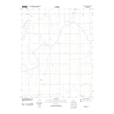
2009 Map of Cheney SE
USGS Topo · Published 2009About this map
The South Fork Ninnescah River meanders across this rural landscape, joined by a network of tributaries including Smoots Creek, Nester Creek, and Fish Creek. Located southwest of Wichita, this area is defined by a rigorous grid of section-line roads and the industrial presence of the Broadway Oil and Gas Field and the Bolinger Oil Field in the northwest. Local history is anchored by small community nodes like Lansdowne and Suppesville, as well as several established burial grounds. Genealogists can find the Vinita Cemetery in the north, while the Mount Pleasant Cemetery and Fairview Cemetery are situated along the primary north-south corridors. The map provides a detailed view of the section lines and rural homesteads that characterize this portion of the Kansas plains in the early 21st century.
Find a feature on this map
30 named features on this map. Tap any name to fly to it.
Don’t see what you’re looking for? This feature index may not catch every label — zoom into the map to look around manually.
Map Details
Editions of this 2009 Cheney SE Map
This is the sole edition of this map. No revisions or reprints were ever made.
Other maps of this area

1889 · Cheney
USGS Topo · 1:125,000

1889 · Caldwell
USGS Topo · 1:125,000

1891 · Cheney
USGS Topo · 1:125,000

1893 · Caldwell
USGS Topo · 1:125,000

1897 · Caldwell
USGS Topo · 1:125,000

1901 · Cheney
USGS Topo · 1:125,000

1955 · Wichita
USGS Topo · 1:250,000

1958 · Wichita
USGS Topo · 1:250,000

1964 · Cheney
USGS Topo · 1:24,000

1965 · Garden Plain
USGS Topo · 1:24,000