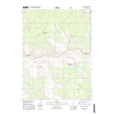
2017 Map of Chepeta Lake
USGS Topo · Published 2017About this map
Ashley National Forest and Wasatch National Forest converge in this high-altitude landscape where the headwaters of the Whiterocks River and Burnt Fork originate. The 2017 survey reveals an intricate network of alpine lakes, including the large Chepeta Lake and the isolated Burnt Fork Lake, connected by long-distance paths such as the Uinta Highline trail. Significant geographic markers like North Pole Pass and Kabell Ridge define the drainage divides between the Summit and Duchesne county lines. This map is particularly valuable for documenting the hydrography of the High Uintas, from the Reeder Basin to smaller glacial features like Moccasin Lake and Papoose Lake. The land is characterized by steep elevation changes and high mountain parks such as Bear Park and McCoy Park, which have historically served as landmarks for navigation in this wilderness area.
Find a feature on this map
56 named features on this map. Tap any name to fly to it.
Don’t see what you’re looking for? This feature index may not catch every label — zoom into the map to look around manually.
Map Details
Editions of this 2017 Chepeta Lake Map
This is the sole edition of this map. No revisions or reprints were ever made.
Other maps of this area

1885 · Ashley
USGS Topo · 1:250,000

1885 · Uinta
USGS Topo · 1:250,000

1905 · Gilbert Peak
USGS Topo · 1:125,000

1906 · Gilbert Peak
USGS Topo · 1:125,000

1906 · Marsh Peak
USGS Topo · 1:125,000

1908 · Marsh Peak
USGS Topo · 1:125,000

1954 · Salt Lake City
USGS Topo · 1:250,000

1954 · Vernal
USGS Topo · 1:250,000

1958 · Vernal
USGS Topo · 1:250,000

1958 · Salt Lake City
USGS Topo · 1:250,000