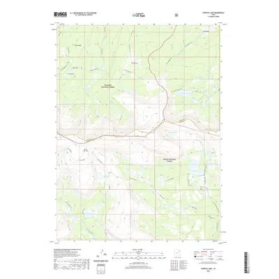
2020 Map of Chepeta Lake
USGS Topo · Published 2020About this map
Ashley National Forest and Wasatch National Forest meet at a high mountain divide in this study of the Uinta Mountains. The terrain is characterized by a high-altitude drainage system, where the Whiterocks River and its various branches, including the W Fork Whiterocks and E Fork Whiterocks River, originate from numerous alpine basins. These basins are clustered with glacial lakes such as Chepeta Lake, Cleveland Lake, and the remote Spirit Lake near the northern boundary. The Uinta Highline trail serves as the primary artery for travel through this wilderness, crossing North Pole Pass and connecting several lake systems. Significant elevation changes are marked by features like Kabell Ridge and Reader Basin, illustrating the complex hydrology of the region as water flows north via Burnt Fork and south toward the Duchesne County line.
Find a feature on this map
42 named features on this map. Tap any name to fly to it.
Don’t see what you’re looking for? This feature index may not catch every label — zoom into the map to look around manually.
Map Details
Editions of this 2020 Chepeta Lake Map
This is the sole edition of this map. No revisions or reprints were ever made.
Other maps of this area

1885 · Ashley
USGS Topo · 1:250,000

1885 · Uinta
USGS Topo · 1:250,000

1905 · Gilbert Peak
USGS Topo · 1:125,000

1906 · Gilbert Peak
USGS Topo · 1:125,000

1906 · Marsh Peak
USGS Topo · 1:125,000

1908 · Marsh Peak
USGS Topo · 1:125,000

1954 · Salt Lake City
USGS Topo · 1:250,000

1954 · Vernal
USGS Topo · 1:250,000

1958 · Vernal
USGS Topo · 1:250,000

1958 · Salt Lake City
USGS Topo · 1:250,000