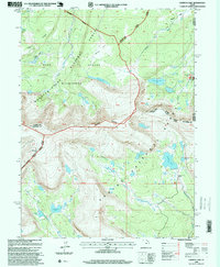
1996 Map of Chepeta Lake
USGS Topo · Published 1999About this map
High Uintas Wilderness dominates this alpine landscape, where the high-altitude drainage patterns of the Whiterocks River and Burnt Fork meet at the triple point of Duchesne, Summit, and Daggett counties. The 1990s revision reveals a terrain defined by glacial basins and high passes, notably North Pole Pass, which serves as a vital crossing between the Wasatch-Cache National Forest and the Ashley National Forest.
Find a feature on this map
47 named features on this map. Tap any name to fly to it.
Don’t see what you’re looking for? This feature index may not catch every label — zoom into the map to look around manually.
Map Details
Editions of this 1996 Chepeta Lake Map
This is the sole edition of this map. No revisions or reprints were ever made.
Other maps of this area

1885 · Ashley
USGS Topo · 1:250,000

1885 · Uinta
USGS Topo · 1:250,000

1905 · Gilbert Peak
USGS Topo · 1:125,000

1906 · Gilbert Peak
USGS Topo · 1:125,000

1906 · Marsh Peak
USGS Topo · 1:125,000

1908 · Marsh Peak
USGS Topo · 1:125,000

1954 · Salt Lake City
USGS Topo · 1:250,000

1954 · Vernal
USGS Topo · 1:250,000

1958 · Vernal
USGS Topo · 1:250,000

1958 · Salt Lake City
USGS Topo · 1:250,000