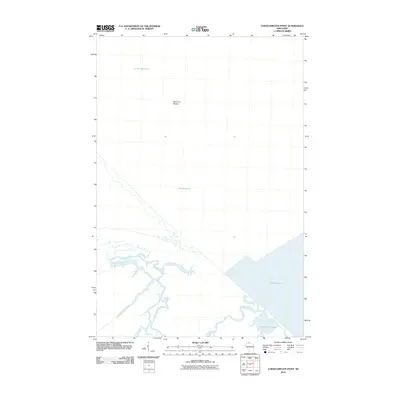
2010 Map of Chequamegon Point
USGS Topo · Published 2010About this map
Lake Superior dominates this coastal landscape where several significant waterways converge near the lake's southern shore. The intricate network of the Kakagon River and Bad River creates a complex wetland environment, characterized by features such as Wood Creek Slough and Beartrap Creek. This area represents a critical intersection of riverine and lacustrine systems, where the freshwater discharge from the mainland meets the open waters of the largest Great Lake. Offshore, Sand Cut Shoals indicates the shifting underwater topography of the coastal shelf. The presence of Honest John Lake further inland suggests the diverse aquatic habitats found within this low-lying riparian zone, reflecting a landscape shaped by centuries of hydraulic action and sediment transport at the river mouths.
Find a feature on this map
7 named features on this map. Tap any name to fly to it.
Don’t see what you’re looking for? This feature index may not catch every label — zoom into the map to look around manually.
Map Details
Editions of this 2010 Chequamegon Point Map
This is the sole edition of this map. No revisions or reprints were ever made.
Other maps of this area

1941 · Bayfield
USGS Topo · 1:48,000

1942 · Ashland
USGS Topo · 1:48,000

1943 · Odanah
USGS Topo · 1:48,000

1945 · Odanah
USGS Topo · 1:48,000

1946 · Bayfield
USGS Topo · 1:48,000

1947 · Ashland
USGS Topo · 1:48,000

1953 · Ashland
USGS Topo · 1:250,000

1958 · Ashland
USGS Topo · 1:250,000
1964 · Ashland East
USGS Topo · 1:24,000
1964 · Bayfield
USGS Topo · 1:62,500