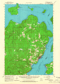
1964 Map of Bayfield
USGS Topo · Published 1965About this map
The Red Cliff Indian Reservation dominates the northern tip of the Bayfield Peninsula, where the land meets the cold waters of Lake Superior. In the mid-1960s, the town of Bayfield remains the primary hub of activity, featuring the Chicago and North Western railroad line and the nearby Bayfield State Fish Hatchery. To the south and east, the West Channel separates the mainland from the Apostle Islands, including Madeline Island with its settlement of La Pointe and the Madeline Island Airfield. This era shows a landscape balancing tribal lands, state conservation efforts like the Apostle Islands State Forest, and local industry represented by numerous Gravel Pits and a Quarry. The interior is marked by the rugged heights of Mt Ashwabay and the vast Sultz Swamp, which feeds the regional drainage of the Raspberry River and Pikes Creek.
Find a feature on this map
65 named features on this map. Tap any name to fly to it.
Don’t see what you’re looking for? This feature index may not catch every label — zoom into the map to look around manually.
Map Details
Editions of this 1964 Bayfield Map
This is the sole edition of this map. No revisions or reprints were ever made.
Other maps of this area

1941 · Bayfield
USGS Topo · 1:48,000

1942 · Ashland
USGS Topo · 1:48,000

1943 · Odanah
USGS Topo · 1:48,000

1944 · Moquah
USGS Topo · 1:48,000

1944 · Cornucopia
USGS Topo · 1:48,000

1945 · Odanah
USGS Topo · 1:48,000

1946 · Cornucopia
USGS Topo · 1:48,000

1946 · Bayfield
USGS Topo · 1:48,000

1947 · Moquah
USGS Topo · 1:48,000

1947 · Ashland
USGS Topo · 1:48,000